Search the Special Collections and Archives Portal
Search Results
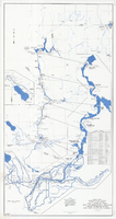
Map and operational diagram, lower Colorado River, Lees Ferry to Gulf of California, June 1973
Date
1973-06
Description
84 x 43 cm. "Map no. 423-300-59." Insets: [Salton Sea]--Operational diagram, no scale. Includes index to gaging stations. Shows dams, canals, levees, pumping plants, etc. "Map compiled from Coast and Geodetic Survey sectional aeronautical charts, and Bureau of Reclamation data." Original publisher: U.S. Dept. of the Interior, Bureau of Reclamation.
Image
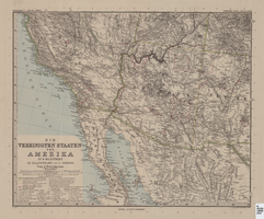
Map of Southwestern United States of America, 1888
Date
1888
Description
33 x 41 cm. Relief shown by hachures and spot heights. 1 sheet of a 6-sheet map. "Petermann: ver. st. v. am. bi. 4". "Stieler's Hand Atlas, No. 86." Binder's title of Hand Atlas über alle Thiele der Erde und über das Weltgebäude, which was published in 1879. In German. Revised 1889. "Neubearbeitret v. H. Habenicht." Original publisher: Justus Perthes, Scale: 1:3,700,000.
Image
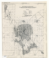
Map of part of Las Vegas Valley showing contours of the composite piezometric surface during the spring of 1944, and specific capacities of wells tapping the confined water
Date
1948
Description
Relief shown by contours. Includes range and township grid. Shows springs and wells. Scale [ca. 1:67,162. 1 in. to approx. 1.06 miles]. Series: Water resources bulletin (Carson City, Nev.)
no. 5. Originally published as plate 8 in Geology and water resources of Las Vegas, Pahrump, and Indian Spring Valleys, Clark and Nye Counties, Nevada by George B. Maxey and C.H. Jameson, which is number 5 of the Water resources bulletin published by the Nevada Office of the State Engineer.
Image
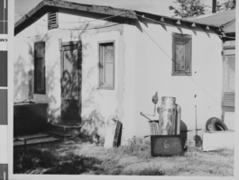
Photograph of a house in West Las Vegas, located adjacent to the North Project Boundary, Las Vegas, Nevada, October, 1957
Date
1957-10
Archival Collection
Description
A house in West Las Vegas adjacent to the North Project Boundary. A sign leaning against a metal tank next to the house has the number "6" on it. The photograph was taken by Henry Elder, City Building Inspector, October, 1957. Refer to photo #0310 0058 (pho017999) for an aerial view of the area.
Image
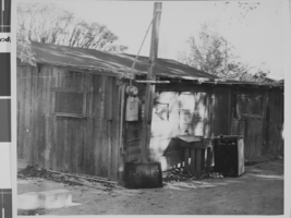
Photograph of a shack house in West Las Vegas, located at 711 Van Buren Avenue, Las Vegas, Nevada, October, 1957
Date
1957-10
Archival Collection
Description
A shack house in West Las Vegas, located at 711 Van Buren Avenue (south side, in a trailer park). A sign leaning against the building has the the numbers "P-5" and R-107" on it. The photograph was taken by Henry Elder, City Building Inspector, October, 1957. Refer to photo #0310 0058 (pho017999) for an aerial view of the area.
Image
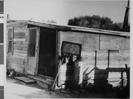
Photograph of a shack house in West Las Vegas, located at 1511 H Street, Las Vegas, Nevada, October, 1957
Date
1957-10
Archival Collection
Description
A shack house in West Las Vegas, located at 1511 H Street. A sign leaning against the building has the numbers "5" and "26" written on it. The photograph was taken by Henry Elder, City Building Inspector, October, 1957. Refer to photo #0310 0058 (pho017999) for an aerial view of the area.
Image
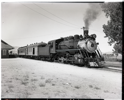
Virginia & Truckee Railroad engine No. 5, circa 1940s
Date
1940 to 1949
Archival Collection
Description
Virginia & Truckee Railroad engine No. 5 stopped at Minden, Nevada. Minden is located in Douglas County, Nevada. The population was 3,001 at the 2010 census. It is the county seat of Douglas County and is adjacent to the city of Gardnerville. It was founded in 1906 by Heinrich Friedrich Dangberg Jr., who named it after the town of Minden, in the German state of North Rhine-Westphalia, which was near his father's birthplace. Minden was founded on company land of the Dangberg Home Ranch and Dangberg commissioned most of the town's early buildings. Minden has had a post office since 1906. U.S. Highway 395 runs through Minden. It is also the terminus of State Route 88, which becomes California State Route 88 on the west side of the state line.
Image
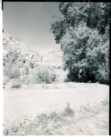
Film transparency of Kershaw Canyon, south of Caliente, Nevada, 1954
Date
1954
Archival Collection
Description
Kershaw Canyon, south of Caliente, Nevada. Kershaw–Ryan State Park is a state park situated in a canyon that was homesteaded in 1873. Located just south of the town of Caliente on Nevada State Route 317, it is in the Eastern Nevada Region of Nevada State Parks. The canyon was settled in 1873 by Samuel and Hannah Kershaw, who operated a ranch called the Meadow Valley Wash Ranch. In 1904, they sold the property to rancher James Ryan, who donated the land to the state in 1926 to be a public park. The Civilian Conservation Corps developed visitor amenities in 1934, and Kershaw–Ryan State Park was officially established the following year.
Image
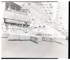
Film transparency of the "Wonders of the Space Age" float in the Helldorado Parade, Fremont Street, Las Vegas, Nevada, May, 1957
Date
1957-05
Archival Collection
Description
Two women ride the "Wonders of the Space Age" float in the Helldorado Parade, May 1957. They are passing the Boulder Club, located at 118 Fremont Street. The Boulder Club was in operation from 1931-1960. A sign on the Boulder Club reads ""Farmer" Page - Enjoy the Old West - Jackpots, Craps, Bar, Keno, Roulette, Twenty-One." The Fremont Casino is visible in the background.
Image
Pagination
Refine my results
Content Type
Creator or Contributor
Subject
Archival Collection
Digital Project
Resource Type
Year
Material Type
Place
Language
Records Classification

