Search Results
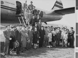
Howard Hughes sitting in the Northrop Gamma Racer in New York after setting new Miami-New York speed record, 1936 April 21
Level of Description
File
Archival Collection
Howard Hughes Public Relations Photograph Collection
To request this item in person:
Collection Number: PH-00373
Collection Name: Howard Hughes Public Relations Photograph Collection
Box/Folder: Folder 01
Collection Name: Howard Hughes Public Relations Photograph Collection
Box/Folder: Folder 01
Archival Component
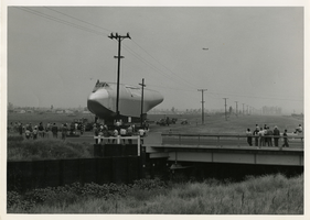
Photograph of the Hughes Flying Boat fuselage in transport, California, June 15, 1945
Date
1945-06-15
Archival Collection
Description
The fuselage of the Hughes Flying Boat is seen in transport on a moving truck rig on a narrow road in the country, on its way to Long Beach Harbor. Small groups of people gather to watch.
Image

Map of California and Territories of New Mexico and Utah, 1862
Date
1862
Description
Scale [ca. 1:3,231,360. 1 in. to approx. 51 miles] (W 125°00--W 103°30/N 42°00--N 31°45) ; 1 map : hand col. ; 40 x 60 cm., on sheet 46 x 68 cm ; Relief indicated by hachures and spot heights ; Prime meridians: Greenwich and Washington, D.C ; Decorative border ; Hand colored ; Atlas p. numbers in upper margin: 58-59 ; Date est. from territorial borders and county configuration ; Shows natural features, locations of Indian tribes, proposed railroad routes, routes of explorers, trails, county boundaries and populated places ; Johnson and Ward
Image
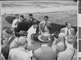
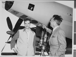
Photograph of Howard Hughes installing radar, Culver City, California, May 03, 1947
Date
1947-05-03
Archival Collection
Description
A view of Howard Hughes conversing with an unidentified group of people in Calfornia.
Image
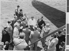
Photograph of Howard Hughes installing radar, Culver City, California, May 03, 1947
Date
1947-05-03
Archival Collection
Description
A view of Howard Hughes conversing with an unidentified group of people in California.
Image
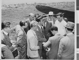
Photograph of Howard Hughes installing radar, Culver City, California, May 03, 1947
Date
1947-05-03
Archival Collection
Description
A view of Howard Hughes conversing with an unidentified group of people in California.
Image
Photograph of Howard Hughes installing radar, Culver City, California, May 03, 1947
Date
1947
Archival Collection
Description
A view of Howard Hughes conversing with an unidentified group of people in Calfornia.
Image
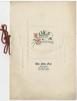
The New Fay Easter dinner menu, Sunday, April 7, 1912
Date
1912-04-07
Archival Collection
Description
Restaurant: The New Fay (Virginia, Minn.) Location: Virginia, Minnesota, United States
Text
Photograph of Howard Hughes with Senator Harry P. Cain, Culver City, California, August 16, 1947
Date
1947-08-16
Archival Collection
Description
A view of Howard Hughes (left) being asked about his controversial XF-11 photo reconnaissance plane by Senator Harry Cain (right), Republican of Washington, in Culver City, California.
Image
Hôtel Bristol menu, February 15, 1890
Date
1890-02-15
Archival Collection
Description
Note: Handwritten menu Restaurant: Hôtel Bristol
Text