Search Results
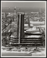
Construction of the Showboat Casino high-rise, Atlantic City, New Jersey: photographic print
Date
1986
Archival Collection
Description
From the Showboat Atlantic City Photograph Collection (PH-00329).
Image
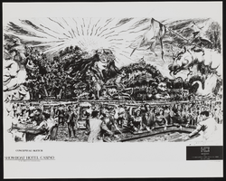
Conceptual sketch of the interior of the Showboat Casino, Atlantic City, New Jersey: photographic print
Date
1986
Archival Collection
Description
From the Showboat Atlantic City Photograph Collection (PH-00329).
Image
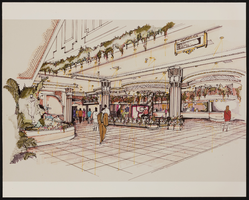
Conceptual sketch of the interior of the Showboat Casino, Atlantic City, New Jersey: photographic print
Date
1986
Archival Collection
Description
From the Showboat Atlantic City Photograph Collection (PH-00329).
Image
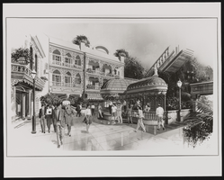
Conceptual sketch of outdoors at the Showboat Hotel, Atlantic City, New Jersey: photographic print
Date
1986
Archival Collection
Description
From the Showboat Atlantic City Photograph Collection (PH-00329).
Image
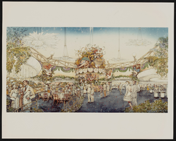
Conceptual sketch of the interior of Showboat Casino, Atlantic City, New Jersey: photographic print
Date
1986
Archival Collection
Description
From the Showboat Atlantic City Photograph Collection (PH-00329).
Image
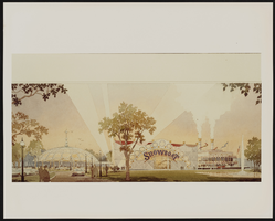
Conceptual sketch of the exterior of Showboat Casino, Atlantic City, New Jersey: photographic print
Date
1986
Archival Collection
Description
From the Showboat Atlantic City Photograph Collection (PH-00329).
Image
Coate, Douglas and Gary Ross, "The Effect of OTB in New York City on Revenues to the City and State Governments", 1975
Level of Description
File
Archival Collection
Eugene Martin Christiansen Papers
To request this item in person:
Collection Number: MS-00561
Collection Name: Eugene Martin Christiansen Papers
Box/Folder: Box 075
Collection Name: Eugene Martin Christiansen Papers
Box/Folder: Box 075
Archival Component
Photographs of March to Los Angeles: L.A. City Hall, Culinary Union, 1992 (folder 1 of 1)
Date
1992
Archival Collection
Description
Arrangement note: Series I. Demonstrations, Subseries I.B. Other Demonstrations and Strikes
Image
Some Effects of an Increase in Police Manpower in the 20th Precinct of New York City by S. James Press, the New York City Rand Institute, 1971 October
Level of Description
File
Archival Collection
Ardis Kearns Papers
To request this item in person:
Collection Number: MS-00348
Collection Name: Ardis Kearns Papers
Box/Folder: Box 16
Collection Name: Ardis Kearns Papers
Box/Folder: Box 16
Archival Component