Search the Special Collections and Archives Portal
Search Results
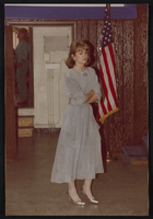
Members at the union hall, Culinary Union, Las Vegas (Nev.), 1990s (folder 1 of 1), image 15
Date
Description
Image
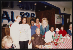
Dinner at union hall, Culinary Union, Las Vegas (Nev.), 1990s (folder 1 of 1), image 15
Date
Description
Image
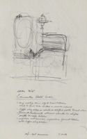
Architectural drawing of Harrah's Marina Hotel Casino (Atlantic City), proposed alterations and rough sketch of the convention hall, July 23, 1982
Date
Archival Collection
Description
Conceptual sketches of Harrah's Atlantic City. Harrah's Marina Hotel Casino later changed its name to Harrah's Resort Atlantic City. Drawn on tissue paper with pencil.
Site Name: Harrah's Marina Resort (Atlantic City)
Address: 777 Harrah's Boulevard, Atlantic City, NJ
Image
Las Vegas Convention Center: East Hall expansion, 1975 October 15; 1977 April 1
Level of Description
Archival Collection
Collection Name: JMA Architecture Studio Records
Box/Folder: Roll 24
Archival Component
Howard Hughes Public Relations Photograph Collection
Identifier
Abstract
The Howard Hughes Public Relations Photograph Collection depicts the activities of businessman Howard Hughes from 1930 to 1950. The photographs primarily depict aircraft flown by Hughes or designed by the Hughes Aircraft Company, including the XF-11 reconnaissance plane, the HK-1 Hercules (or "Spruce Goose"), and the Hughes H-1 Racer. The photographs also depict celebrations following Hughes's circumnavigation flight in New York City, New York and Chicago, Illinois in 1938. Lastly, the photographs include Hughes testifying in front of the Senate Special Committee to Investigate the National Defense Program in 1947.
Archival Collection
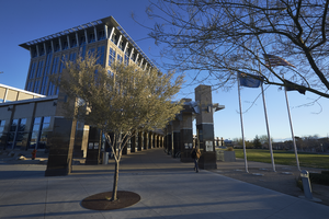
Exterior view of the North Las Vegas City Hall building, looking east-northeast in North Las Vegas, Nevada: digital photograph
Date
Archival Collection
Description
From the UNLV University Libraries Photographs of the Development of the Las Vegas Valley, Nevada (PH-00394). Part of the collection documents the entire 19 mile length of the north/south Eastern Avenue / Civic Center Drive alignment. This photograph was captured in the section of Civic Center Drive between Las Vegas Boulevard and Lake Mead Boulevard.
Image
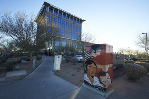
A mural on an electrical box outside of North Las Vegas City Hall, looking east in North Las Vegas, Nevada: digital photograph
Date
Archival Collection
Description
From the UNLV University Libraries Photographs of the Development of the Las Vegas Valley, Nevada (PH-00394). Part of the collection documents the entire 19 mile length of the north/south Eastern Avenue / Civic Center Drive alignment. This photograph was captured in the section of Civic Center Drive between Las Vegas Boulevard and Lake Mead Boulevard.
Image
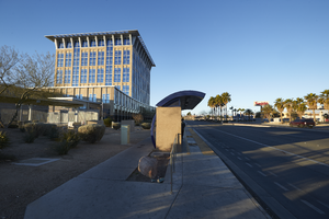
Bus stop in front of the North Las Vegas City Hall building, looking west in North Las Vegas, Nevada: digital photograph
Date
Archival Collection
Description
From the UNLV University Libraries Photographs of the Development of the Las Vegas Valley, Nevada (PH-00394). Part of the collection documents the entire 19 mile length of the north/south Eastern Avenue / Civic Center Drive alignment. This photograph was captured in the section of Civic Center Drive between Las Vegas Boulevard and Lake Mead Boulevard.
Image
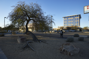
Landscaping in front of North Las Vegas City Hall building and Walgreens, looking west in North Las Vegas, Nevada: digital photograph
Date
Archival Collection
Description
From the UNLV University Libraries Photographs of the Development of the Las Vegas Valley, Nevada (PH-00394). Part of the collection documents the entire 19 mile length of the north/south Eastern Avenue / Civic Center Drive alignment. This photograph was captured in the section of Civic Center Drive between Las Vegas Boulevard and Lake Mead Boulevard.
Image
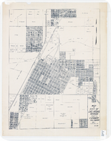
Map of city of Las Vegas, Nevada, October 1, 1940
Date
Description
Image
