Search Results
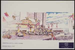
Conceptual sketch of the porte cochere at the Showboat Casino, Atlantic City, New Jersey
Date
1986
Archival Collection
Description
From the Showboat Atlantic City Photograph Collection (PH-00329).
Image
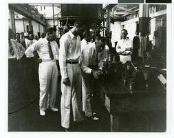
Photograph of Howard Hughes visiting the Hughes Tool Company, Houston, Texas, July 30, 1938
Date
1938-07-30
Archival Collection
Description
Howard Hughes (foreground) and S. P. Brown (bending over) examining the new Hughes rock bit head at the Hughes Tool Company plant.
Image
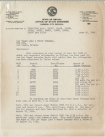
Letter from Hugh A. Shamberger (Carson City) to Las Vegas Land and Water Company (Las Vegas), June 21, 1950
Date
1950-06-21
Archival Collection
Description
List of wells owned by the Las Vegas Land and Water Company and the amount of water granted to each.
Text
T-Shirt Color: Gray; Front: New York City FDNY Firefighters; Handwritten Text: ENG 205, LDR 118 Peter Vega We Love You - Your Bro Paul, approximately 2001-2012
Level of Description
File
Archival Collection
New York-New York Hotel and Casino 9-11 Heroes Tribute Collection
To request this item in person:
Collection Number: MS-00459
Collection Name: New York-New York Hotel and Casino 9-11 Heroes Tribute Collection
Box/Folder: Box 240
Collection Name: New York-New York Hotel and Casino 9-11 Heroes Tribute Collection
Box/Folder: Box 240
Archival Component
T-Shirt Color: Navy Blue; Front: FDNY; Back: Dedicated To Those Who Have Made The Ultimate Sacrifice Fire Department City Of New York FDNY, Dept. Badge Emblem, approximately 2001-2012
Level of Description
File
Archival Collection
New York-New York Hotel and Casino 9-11 Heroes Tribute Collection
To request this item in person:
Collection Number: MS-00459
Collection Name: New York-New York Hotel and Casino 9-11 Heroes Tribute Collection
Box/Folder: Box 52
Collection Name: New York-New York Hotel and Casino 9-11 Heroes Tribute Collection
Box/Folder: Box 52
Archival Component
Joint Legislative Taskforce to Study and Evaluate the Pari-mutuel Racing and Breeding Industry in New York State
Level of Description
File
Archival Collection
Eugene Martin Christiansen Papers
To request this item in person:
Collection Number: MS-00561
Collection Name: Eugene Martin Christiansen Papers
Box/Folder: N/A
Collection Name: Eugene Martin Christiansen Papers
Box/Folder: N/A
Archival Component

Map of California, Nevada, Utah, Colorado, Arizona & New Mexico, circa 1867
Date
1865 to 1869
Description
39 x 62 cm. Relief shown by hachures and spot heights. Prime meridian: Greenwich and Washington. Hand colored. Shows natural features, populated places, routes of mail steamships, routes of explorers, locations of Indian tribes, railroad routes, and proposed railroad routes. In top margin: No. 80-81. On verso: New Mexico, Arizona, Colorado, Idaho, Dakota (statistics and other information) and The state of California (statistics and other information). Original publisher: G.W. and C.B. Colton.
Image

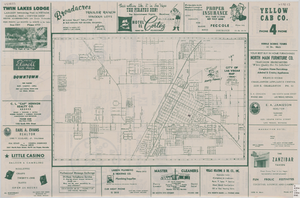
Street map of the city of Las Vegas, 1954
Date
1954
Description
22 x 34 cm. on sheet 36 x 54 cm. Copyright held by Redwood Publishing Co. Includes advertisements. 1954 [ed.] Street index, map of the Strip and advertisements on verso. Map is irregularly shaped. Original publisher: Redwood Pub. Co..
Image
T-Shirt Color: White; Front: Memory Of World Trade Center People Of America United!, American Flag And Twin Towers; Handwritten Text: The Gordian Family New York New York United We Stand Yonkers, NY, approximately 2001-2012
Level of Description
File
Archival Collection
New York-New York Hotel and Casino 9-11 Heroes Tribute Collection
To request this item in person:
Collection Number: MS-00459
Collection Name: New York-New York Hotel and Casino 9-11 Heroes Tribute Collection
Box/Folder: Box 268
Collection Name: New York-New York Hotel and Casino 9-11 Heroes Tribute Collection
Box/Folder: Box 268
Archival Component