Search Results
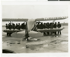
Photograph of police in readiness for arrival of Howard Hughes' plane at Floyd Bennett Airport, New York, July 14, 1938
Date
Archival Collection
Description
Image
Attorneys and statutory agents - appointment in New York City, 1911-1960
Level of Description
Archival Collection
Collection Name: Union Pacific Railroad Collection
Box/Folder: Box 56
Archival Component

Map of economical features of parts of southern Colorado and northern New Mexico, January 8, 1878
Date
Description
37 x 49 cm. Relief shown by hachures and spot heights. "Atlas sheet no. 69(B)." "Issued Jan'y 8th 1878." "Expeditions of 1874-1875 & 1877 under the command of 1st. Lieut. Geo. M. Wheeler, Corps of Engineers, U.S. Army." Prime meridians: Greenwich and Washington, D.C. "Weyss, Lang & Herman, del." "By order of the honorable the Secretary of War." "Under the direction of Brig. General A. A. Hunphreys, Chief of Engineers, U. S. Army." Original publisher: U.S. Geographical Surveys West of the 100th Meridian, Scale: 1 inch to 4 miles or 1: 253440.
Image
National City Bank of New York account transactions, 1932 April to 1933 February
Level of Description
Archival Collection
Collection Name: Howard Hughes Film Production Records
Box/Folder: Box 089 (Restrictions apply)
Archival Component
Garden Pier, Atlantic City, New Jersey: photograph, 1936 to 1937
Level of Description
Archival Collection
Collection Name: Larry Fotine Music collection
Box/Folder: Digital File 00
Archival Component
Steel Pier marquee, Atlantic City, New Jersey: photograph, 1951
Level of Description
Archival Collection
Collection Name: Larry Fotine Music collection
Box/Folder: Digital File 00
Archival Component
Steel Pier marquee, Atlantic City, New Jersey: photograph, 1939
Level of Description
Archival Collection
Collection Name: Larry Fotine Music collection
Box/Folder: Digital File 00
Archival Component
Steel Pier marquee, Atlantic City, New Jersey: photograph, 1939
Level of Description
Archival Collection
Collection Name: Larry Fotine Music collection
Box/Folder: Digital File 00
Archival Component
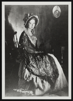
Clara Bow after winning the National Fame and Fortune Contest in New York City, New York: photographic print
Date
Description
Image
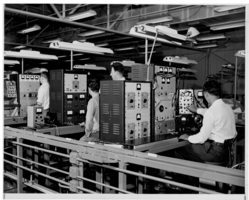
Photograph of electronic equipment testing at Hughes Aircraft Company, Culver City, California, 1959
Date
Archival Collection
Description
Image