Search the Special Collections and Archives Portal
Search Results

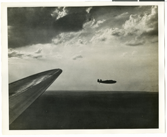
Photograph of the Lockheed 14 aircraft over New York City, July 1938
Date
1938-07
Archival Collection
Description
The black and white view of Howard Hughes plane in flight over New York City, July 1938
Image
Boulder City City Hall, 1973
Level of Description
File
Archival Collection
Historic Building Survey Collection
To request this item in person:
Collection Number: MS-00762
Collection Name: Historic Building Survey Collection
Box/Folder: Box 01
Collection Name: Historic Building Survey Collection
Box/Folder: Box 01
Archival Component
Howard Hughes inside of City Hall after completing his around-the-world flight, 1938 July 15
Level of Description
File
Archival Collection
Howard Hughes Public Relations Photograph Collection
To request this item in person:
Collection Number: PH-00373
Collection Name: Howard Hughes Public Relations Photograph Collection
Box/Folder: Folder 12
Collection Name: Howard Hughes Public Relations Photograph Collection
Box/Folder: Folder 12
Archival Component
Howard Hughes, Mayor Fiorello La Guardia, and Grover Whalen leaving City Hall, 1938 July 15
Level of Description
File
Archival Collection
Howard Hughes Public Relations Photograph Collection
To request this item in person:
Collection Number: PH-00373
Collection Name: Howard Hughes Public Relations Photograph Collection
Box/Folder: Folder 13
Collection Name: Howard Hughes Public Relations Photograph Collection
Box/Folder: Folder 13
Archival Component

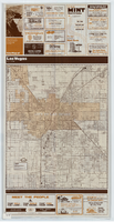
City map of Las Vegas, 1973
Date
1905-05-26
Description
Color; 55 x 45 cm., on sheet 95 x 47 cm., folded to 24 x 10 cm. Panel title: Las Vegas city map. Copyright held by Cardinal Publishing Company. Relief shown by hachures. Includes illustrations and advertisements. Index, text, illustrations, advertisements, and map of "Lake Mead National Recreation Area, lower basin section" on verso. Original publisher: Cardinal Publishing Company.
Image

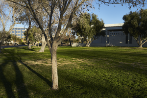
Landscaping in front of the former North Las Vegas City Hall building with new City Hall building in background in North Las Vegas, Nevada: digital photograph
Date
2019-02-06
Archival Collection
Description
From the UNLV University Libraries Photographs of the Development of the Las Vegas Valley, Nevada (PH-00394). Part of the collection documents the entire 19 mile length of the north/south Eastern Avenue / Civic Center Drive alignment. This photograph was captured in the section of Civic Center Drive between Las Vegas Boulevard and Lake Mead Boulevard.
Image

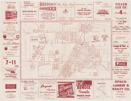
Map of the city of Las Vegas, 1953
Date
1953
Description
24 x 38 cm. on sheet 43 x 56 cm., folded to 28 x 13 cm. Includes advertisements for Las Vegas businesses. Advertisements for Las Vegas businesses, inset map of North Las Vegas, and index on verso. Copyright held by Redwood Pub. Co. Includes inset map of the Strip (U.S. 91 or Los Angeles Highway). Map is irregularly shaped. Original publisher: Redwood Pub. Co..
Image
Howard Hughes in a crowd of people after his around-the-world flight, New York City, New York, 1938 July 13
Level of Description
File
Archival Collection
Howard Hughes Professional and Aeronautical Photographs
To request this item in person:
Collection Number: PH-00321
Collection Name: Howard Hughes Professional and Aeronautical Photographs
Box/Folder: Folder 06
Collection Name: Howard Hughes Professional and Aeronautical Photographs
Box/Folder: Folder 06
Archival Component
Pagination
Refine my results
Content Type
Creator or Contributor
Subject
Archival Collection
Digital Project
Resource Type
Year
Material Type
Place
Language
Records Classification
