Search the Special Collections and Archives Portal
Search Results
Hughes Aircraft Stock Footage for the Discovery Channel- Flying Boat Howard Hughes Culver City Plant-Camera Original, 1997 December
Level of Description
File
Archival Collection
Hughes Electronics Corporation Records
To request this item in person:
Collection Number: MS-00485
Collection Name: Hughes Electronics Corporation Records
Box/Folder: Box 11
Collection Name: Hughes Electronics Corporation Records
Box/Folder: Box 11
Archival Component

Harrah's at Trump Plaza in Atlantic City, New Jersey: postcard
Date
1940 (year approximate) to 1990 (year approximate)
Archival Collection
Description
From Harvey's Hotel and Casino Postcard Collection (PH-00367)
Image

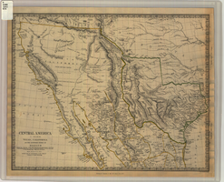
Map of Texas, California, New Mexico and the northern states of Mexico, October 15, 1842
Date
1842-10-15
Description
'Published under the superintendence of the Society for Diffusion of Useful Knowledge.' 'Published by Chapman & Hall, 186 Strand, 15 Oct. 1842.' 'J. & C. Walker, Sculpt.' Scale [ca. 1:7,600,000]. 1 in. to ca. 120 miles (W 125°--W 91°/N 43°--N 23° 30?). 1 map ; 31 x 39 cm. Relief indicated by hachures and spot heights. Shows elevations in yards. Includes notes on exploring expeditions, etc. Borders hand colored. Chapman & Hall.
Image
Adamar of New Jersey License Application, December 15, 1981
Level of Description
File
Archival Collection
International Association of Gaming Attorneys Collection
To request this item in person:
Collection Number: MS-00250
Collection Name: International Association of Gaming Attorneys Collection
Box/Folder: Box 01
Collection Name: International Association of Gaming Attorneys Collection
Box/Folder: Box 01
Archival Component

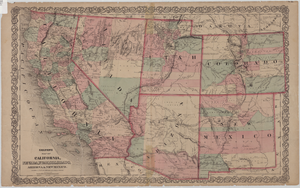
Map of California, Nevada, Utah, Colorado, Arizona & New Mexico, circa 1867
Date
1865 to 1869
Description
39 x 62 cm. Relief shown by hachures and spot heights. Prime meridian: Greenwich and Washington. Hand colored. Shows natural features, populated places, routes of mail steamships, routes of explorers, locations of Indian tribes, railroad routes, and proposed railroad routes. In top margin: No. 80-81. On verso: New Mexico, Arizona, Colorado, Idaho, Dakota (statistics and other information) and The state of California (statistics and other information). Original publisher: G.W. and C.B. Colton.
Image
#04368: Biology Graduate Students, 1981 July 15
Level of Description
File
Archival Collection
University of Nevada, Las Vegas Creative Services Records (1980s)
To request this item in person:
Collection Number: PH-00388-02
Collection Name: University of Nevada, Las Vegas Creative Services Records (1980s)
Box/Folder: N/A
Collection Name: University of Nevada, Las Vegas Creative Services Records (1980s)
Box/Folder: N/A
Archival Component
#57408: Maxson, Robert (President), 1988 July 15
Level of Description
File
Archival Collection
University of Nevada, Las Vegas Creative Services Records (1980s)
To request this item in person:
Collection Number: PH-00388-02
Collection Name: University of Nevada, Las Vegas Creative Services Records (1980s)
Box/Folder: N/A
Collection Name: University of Nevada, Las Vegas Creative Services Records (1980s)
Box/Folder: N/A
Archival Component
#57411: Hotel - Foreign Students, 1988 July 15
Level of Description
File
Archival Collection
University of Nevada, Las Vegas Creative Services Records (1980s)
To request this item in person:
Collection Number: PH-00388-02
Collection Name: University of Nevada, Las Vegas Creative Services Records (1980s)
Box/Folder: N/A
Collection Name: University of Nevada, Las Vegas Creative Services Records (1980s)
Box/Folder: N/A
Archival Component
#56947: Bradley, Dave with Group, 1987 July 15
Level of Description
File
Archival Collection
University of Nevada, Las Vegas Creative Services Records (1980s)
To request this item in person:
Collection Number: PH-00388-02
Collection Name: University of Nevada, Las Vegas Creative Services Records (1980s)
Box/Folder: N/A
Collection Name: University of Nevada, Las Vegas Creative Services Records (1980s)
Box/Folder: N/A
Archival Component
#59092: BG Tower (Phone), 1991 July 15
Level of Description
File
Archival Collection
University of Nevada, Las Vegas Creative Services Records (1990s)
To request this item in person:
Collection Number: PH-00388-03
Collection Name: University of Nevada, Las Vegas Creative Services Records (1990s)
Box/Folder: N/A
Collection Name: University of Nevada, Las Vegas Creative Services Records (1990s)
Box/Folder: N/A
Archival Component
Pagination
Refine my results
Content Type
Creator or Contributor
Subject
Archival Collection
Digital Project
Resource Type
Year
Material Type
Place
Language
Records Classification
