Search Results

Photograph of Howard Hughes' plane at Floyd Bennet Airfield, New York, August 20, 1938
Date
Archival Collection
Description
Image
Letter from Hugh A. Shamberger (Carson City) to Colonel H. F. Clark (Las Vegas), December 11, 1951
Date
Archival Collection
Description
Shamberger advised the Water District to purchase the lands surrounding the Las Vegas Springs as well as other springs and wells in the area to protect its water sources in the future.
Text
Hughes H-1 Racer photographs, 1937
Level of Description
Scope and Contents
Materials depict the Hughes H-1 Racer in 1937. The photographs primarily depict Howard Hughes standing with the plane or in the plane's cockpit. The plane was designed by Glenn Odekirk and built by Hughes Aircraft Company in 1935, the first plane produced by the company. Hughes broke several records in the H-1, including the landplane speed record in 1935. In 1937, Hughes broke his own transcontinental speed record by flying from Los Angeles, California to New York City, New York in 7 hours, 28 minutes. Despite its speed, Hughes was unable to sell the H-1 to the U.S. military.
Archival Collection
Collection Name: Howard Hughes Public Relations Photograph Collection
Box/Folder: N/A
Archival Component
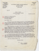
Photograph of crowds at Floyd Bennett Airfield, New York, July 14, 1938
Date
Archival Collection
Description
Image
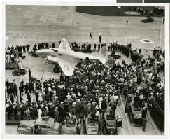
Photograph of the Hughes Flying Boat wing under construction, Culver City, California, June 1, 1945
Date
Archival Collection
Description
Image

Map of the territories of New Mexico, Arizona, Colorado, Nevada, and Utah, 1855
Date
Description
Image
Caesars Boardwalk Regency, Atlantic City, New Jersey
Level of Description
Archival Collection
Collection Name: Nat Hart Professional Papers
Box/Folder: N/A
Archival Component
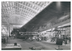
Photograph of Howard Hughes behind his plane at Le Bourget Airfield, France, July 1938
Date
Archival Collection
Description
Image
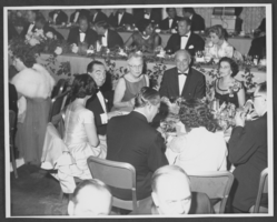
Photograph of Wilbur Clark at a formal dinner, New York City, 1958
Date
Archival Collection
Description
Image
City College New York assignments, 1925 to 1929
Level of Description
Archival Collection
Collection Name: Arnold Shaw Papers
Box/Folder: Box 10
Archival Component