Search the Special Collections and Archives Portal
Search Results

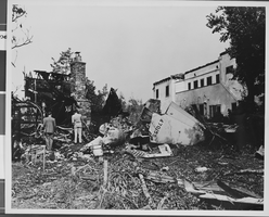
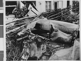
Photograph of crash of Howard Hughes' XF-11, Culver City, California, July 07, 1946
Date
1946-07-07
Archival Collection
Description
A view of the near-fatal crash of Howard Hughes' XF-11 in Culver City, California.
Image

Photograph of crash of Howard Hughes' XF-11, Culver City, California, July 07, 1946
Date
1946-07-07
Archival Collection
Description
A view of the near-fatal crash of Howard Hughes' XF-11 in Culver City, California.
Image

Photograph of crash of Howard Hughes' XF-11, Culver City, California, July 07, 1946
Date
1946-07-07
Archival Collection
Description
A view of the near-fatal crash of Howard Hughes' XF-11 in Culver City, California.
Image

Photograph of crash of Howard Hughes' XF-11, Culver City, California, July 07, 1946
Date
1946-07-07
Archival Collection
Description
A view of the near-fatal crash of Howard Hughes' XF-11 in Culver City, California.
Image

Photograph of crash of Howard Hughes' XF-11, Culver City, California, July 07, 1946
Date
1946-07-07
Archival Collection
Description
A view of the near-fatal crash of Howard Hughes' XF-11 in Culver City, California.
Image
Watercolor sketches: Central Park, New York City, New York, undated
Level of Description
File
Archival Collection
Jeanne Russell Janish Papers
To request this item in person:
Collection Number: MS-00355
Collection Name: Jeanne Russell Janish Papers
Box/Folder: Oversized Box 16
Collection Name: Jeanne Russell Janish Papers
Box/Folder: Oversized Box 16
Archival Component
Wilbur Clark at a formal dinner, New York City, New York, 1958
Level of Description
File
Archival Collection
Toni and Wilbur Clark Photographs
To request this item in person:
Collection Number: PH-00302
Collection Name: Toni and Wilbur Clark Photographs
Box/Folder: Folder 10
Collection Name: Toni and Wilbur Clark Photographs
Box/Folder: Folder 10
Archival Component
Howard Hughes and co-pilot Joseph Bartles at the controls of their Lockheed Constellation after landing at LaGuardia Field in New York City, 1946 February 15
Level of Description
File
Archival Collection
Howard Hughes Public Relations Photograph Collection
To request this item in person:
Collection Number: PH-00373
Collection Name: Howard Hughes Public Relations Photograph Collection
Box/Folder: Folder 20
Collection Name: Howard Hughes Public Relations Photograph Collection
Box/Folder: Folder 20
Archival Component
Howard Hughes sitting inside of a B-23 converted bomber before taking off for New York City in Los Angeles, California, 1946 September 11
Level of Description
File
Archival Collection
Howard Hughes Public Relations Photograph Collection
To request this item in person:
Collection Number: PH-00373
Collection Name: Howard Hughes Public Relations Photograph Collection
Box/Folder: Folder 22
Collection Name: Howard Hughes Public Relations Photograph Collection
Box/Folder: Folder 22
Archival Component
Pagination
Refine my results
Content Type
Creator or Contributor
Subject
Archival Collection
Digital Project
Resource Type
Year
Material Type
Place
Language
Records Classification
