Search Results

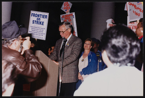
March to Los Angeles: L.A. City Hall, Culinary Union, 1992 (folder 1 of 1), image 17
Date
1992
Description
Arrangement note: Series I. Demonstrations, Subseries I.B. Other Demonstrations and Strikes
Image
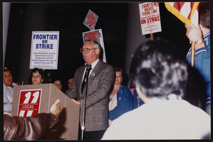
March to Los Angeles: L.A. City Hall, Culinary Union, 1992 (folder 1 of 1), image 18
Date
1992
Description
Arrangement note: Series I. Demonstrations, Subseries I.B. Other Demonstrations and Strikes
Image
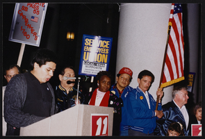
March to Los Angeles: L.A. City Hall, Culinary Union, 1992 (folder 1 of 1), image 19
Date
1992
Description
Arrangement note: Series I. Demonstrations, Subseries I.B. Other Demonstrations and Strikes
Image

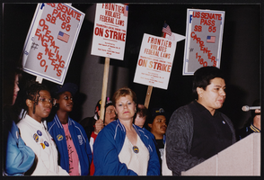
March to Los Angeles: L.A. City Hall, Culinary Union, 1992 (folder 1 of 1), image 20
Date
1992
Description
Arrangement note: Series I. Demonstrations, Subseries I.B. Other Demonstrations and Strikes
Image

March to Los Angeles: L.A. City Hall, Culinary Union, 1992 (folder 1 of 1), image 21
Date
1992
Description
Arrangement note: Series I. Demonstrations, Subseries I.B. Other Demonstrations and Strikes
Image
March to Los Angeles: L.A. City Hall, Culinary Union, 1992 (folder 1 of 1), image 22
Date
1992
Description
Arrangement note: Series I. Demonstrations, Subseries I.B. Other Demonstrations and Strikes
Image
March to Los Angeles: L.A. City Hall, Culinary Union, 1992 (folder 1 of 1), image 23
Date
1992
Description
Arrangement note: Series I. Demonstrations, Subseries I.B. Other Demonstrations and Strikes
Image

March to Los Angeles: L.A. City Hall, Culinary Union, 1992 (folder 1 of 1), image 24
Date
1992
Description
Arrangement note: Series I. Demonstrations, Subseries I.B. Other Demonstrations and Strikes
Image

March to Los Angeles: L.A. City Hall, Culinary Union, 1992 (folder 1 of 1), image 25
Date
1992
Description
Arrangement note: Series I. Demonstrations, Subseries I.B. Other Demonstrations and Strikes
Image

March to Los Angeles: L.A. City Hall, Culinary Union, 1992 (folder 1 of 1), image 26
Date
1992
Description
Arrangement note: Series I. Demonstrations, Subseries I.B. Other Demonstrations and Strikes
Image