Search Results
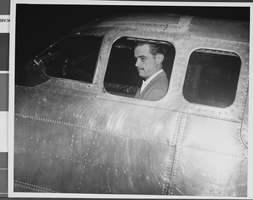
Photograph of Howard Hughes, Los Angeles, September 11, 1946
Date
1946-09-11
Archival Collection
Description
A view of Howard Hughes sitting inside of a B-23 converted bomber before taking off for New York City in Los Angeles, California.
Image
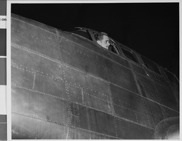
Photograph of Howard Hughes, Los Angeles, September 11, 1946
Date
1946-09-11
Archival Collection
Description
A view of Howard Hughes sitting inside of a B-23 converted bomber before taking off for New York City in Los Angeles, California.
Image
New York City Off-track Betting System Review of Australian Tote Study, 1977
Level of Description
File
Archival Collection
Eugene Martin Christiansen Papers
To request this item in person:
Collection Number: MS-00561
Collection Name: Eugene Martin Christiansen Papers
Box/Folder: Box 175
Collection Name: Eugene Martin Christiansen Papers
Box/Folder: Box 175
Archival Component
New York City Off-track Betting Corporation annual reports, 1990, 1997-1998
Level of Description
File
Archival Collection
Eugene Martin Christiansen Papers
To request this item in person:
Collection Number: MS-00561
Collection Name: Eugene Martin Christiansen Papers
Box/Folder: Box 041
Collection Name: Eugene Martin Christiansen Papers
Box/Folder: Box 041
Archival Component
Photograph of Howard Hughes and others with the Hughes XH-17 plane, circa 1952
Date
1951 to 1953
Archival Collection
Description
Howard Hughes (right) and others standing in front of Hughes XH-17.
Image
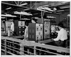
Photograph of electronic equipment testing at Hughes Aircraft Company, Culver City, California, 1959
Date
1959
Archival Collection
Description
Technicians working with large pieces of electronic equipment.
Image
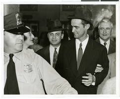
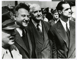
Photograph of Howard in Washington, D. C., July 21, 1938
Date
1938-07-21
Archival Collection
Description
Description printed on photograph's accompanying sheet of paper: "Howard Hughes being escorted through crowd after delivering an address at the National Press Club on July 21."
Image
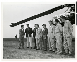
Photograph of Howard Hughes with a group of men in front of the XH-17 helicopter, Culver City, California, October 23, 1952
Date
1952
Archival Collection
Description
Howard Hughes (second from left) standing in front of the experimental helicopter XH-17, Flying Crane, with others (from left to right): Rea Hopper, Director of the Aeronautical Division, Hughes Aircraft Company; Hughes; Clyde Jones, Director of Engineering, Hughes Tool Company Aeronautical Division; Warren Reed, Assistant; Colonel Carl E. Jackson, Air Research and Development Headquarters, Baltimore; Gale J. Moore, Pilot; possibly Chal Bowen, Flight Engineer/Co-pilot, and an unidentified man, October 23, 1952.
Image
New York City trip. Includes correspondence, invitations and copy of speech, 1972 April 13
Level of Description
File
Archival Collection
Howard Cannon Papers
To request this item in person:
Collection Number: MS-00002
Collection Name: Howard Cannon Papers
Box/Folder: Box 04 (Trips)
Collection Name: Howard Cannon Papers
Box/Folder: Box 04 (Trips)
Archival Component
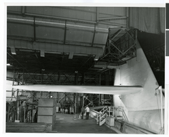
Photograph of the interior of an airplane hangar at the Hughes Helicopters Division of Summa Corporation, Culver City, California, circa late 1950s
Date
1957 to 1959
Archival Collection
Description
A view of the inside of an airplane hangar at the Hughes Helicopters Division of Summa Corporation in Culver City, California in the late 1950s.
Image