Search the Special Collections and Archives Portal
Search Results

New York New York Hotel and Casino: postcards, image 013
Description

Hall and Mirrors
Date
Archival Collection
Description
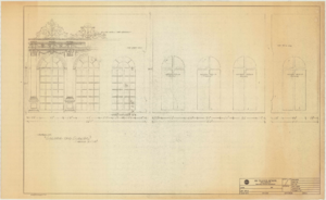
Series II. Folies-Bergere production papers, designs, and photographs -- 15th Edition partial revision -- Set design drawings by Charles Lisanby
Image
Hughes Aircraft HK-1 or Flying Boat wing assembly being completed in a hangar in Hughes's factory in Culver City, California, approximately 1942-1946
Level of Description
Archival Collection
Collection Name: Howard Hughes Professional and Aeronautical Photographs
Box/Folder: Folder 05
Archival Component

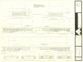
Architectural drawing of concert hall and drama theater, University of Nevada, Las Vegas, exterior elevations, November 5, 1969
Date
Archival Collection
Description
Exterior elevations for the concert hall and drama theater on the University of Nevada, Las Vegas campus, including a connecting courtyard. These buildings would become the Artemus W. Ham Concert Hall and the Judy Bayley Theatre. Sheet 6 of 35. "Drawn by G.T. Checked by K.D. Job number 6828. Scale 1/16" = 1'-0". Date Nov. 5, 1969"
Site Name: University of Nevada, Las Vegas
Address: 4505 S. Maryland Parkway
Image
Unknown author. Mahue wins suit over a statement by Howard Hughes, New York Times, 1974 July 02
Level of Description
Archival Collection
Collection Name: UNLV Libraries Collection of Articles on Gaming and Las Vegas, Nevada Topics
Box/Folder: Box 12
Archival Component

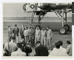
Photograph of Howard Hughes and others in front of the XH-17 helicopter, Culver City, California, October 23, 1952
Date
Archival Collection
Description
Image

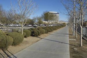
A sidewalk leads to the North Las Vegas City Hall, looking north in North Las Vegas, Nevada: digital photograph
Date
Archival Collection
Description
From the UNLV University Libraries Photographs of the Development of the Las Vegas Valley, Nevada (PH-00394). Part of the collection documents the entire 19 mile length of the north/south Eastern Avenue / Civic Center Drive alignment. This photograph was captured in the section of Civic Center Drive between Las Vegas Boulevard and Lake Mead Boulevard.
Image
Crew of Anderson Brothers Mess Hall in Boulder City, Nevada: photographic print, 1932
Level of Description
Archival Collection
Collection Name: UNLV Libraries Single Item Accession Photograph Collection
Box/Folder: Folder 13
Archival Component

Hotel Construction: Monte Carlo, New York-New York, and Stratosphere, Culinary Union, Las Vegas (Nev.), 1996 June (folder 1 of 1), image 15
Date
Description
Image
#04881: High Tech Meeting at Artemus W. Ham Concert Hall, 1982 December 15
Level of Description
Archival Collection
Collection Name: University of Nevada, Las Vegas Creative Services Records (1980s)
Box/Folder: N/A
Archival Component
