Search Results
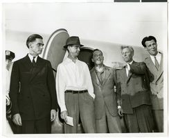
Photograph of Howard Hughes and his crew in Floyd Bennett Field, New York, July 10, 1938
Date
1938-07-10
Archival Collection
Description
The black and white view of Howard Hughes and his crew before leaving for Paris.
Image
Photograph of Howard Hughes and his crew in Floyd Bennett Field, New York, July 10, 1938
Date
1938-07-10
Archival Collection
Description
The black and white view of Howard Hughes and his crew before leaving for Paris.
Image
Photograph of Howard Hughes and his crew in Floyd Bennett Field, New York, July 10, 1938
Date
1938-07-10
Archival Collection
Description
The black and white view of Howard Hughes and his crew before leaving for Paris.
Image

Map of California and territories of New Mexico and Utah, circa 1861
Date
1859 to 1862
Description
'Compiled, drawn, and engraved under the supervision of J.H. Colton and A.J. Johnson.' Relief shown by hachures and spot heights. Scale [ca. 1:3,041,280]. 1 in. to approx. 48 miles (W 124°--W 103°/N 42°--N 31°). Hand colored
Prime meridians: Greenwich and Washington
Plates 54 & 55 removed from Johnson's New illustrated family atlas of the world, with descriptions geographical, statistical and historical ... New York, 1862
Title page of atlas.
Prime meridians: Greenwich and Washington
Plates 54 & 55 removed from Johnson's New illustrated family atlas of the world, with descriptions geographical, statistical and historical ... New York, 1862
Title page of atlas.
Image
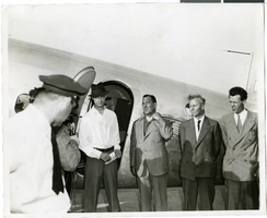
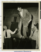
Photograph of Howard Hughes and others at Newark Airport, New Jersey, July 21, 1938
Date
1938-07-21
Archival Collection
Description
Typed onto a piece of paper attached to the image: "Howard Hughes in center leaves Newark Airport with party enroute to Washington, D.C. 7/21/38."
Image
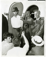
Photograph of Howard Hughes emerging from his Douglas DC-3, New York, April, 1947
Date
1947-04
Archival Collection
Description
Howard Hughes emerging from his airplane after landing in New York. This was his first flight after the nearly fatal XF-11 prototype crash in 1946.
Image
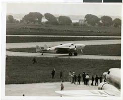
Photograph of the landing of Howard Hughes' Lockheed 14 aircraft, New York, July 14, 1938
Date
1938-07-14
Archival Collection
Description
The black and white view of Howard Hughes' Lockheed 14 aircraft performing its final landing on the Round the World flight at Floyd Bennett Airport, New York. Typed onto a piece of paper attached to the image: "Landing completed - 7-14-38. (Daily News)."
Image
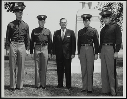
Howard Cannon visits West Point, New York with four unidentified cadets: photographic print
Date
1970-10-08
Archival Collection
Description
From the Howard Cannon Photograph Collection (PH-00192). Stamped on verso: "Signal Division File #USMA-64-1996 NR West Point New York 25 May 64 - Photo by Mr Murphy". Stamped on verso: "Please give credit as 'U.S. Army Photograph'"
Image
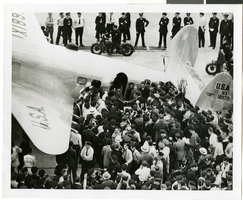
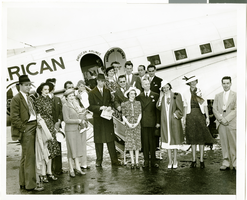
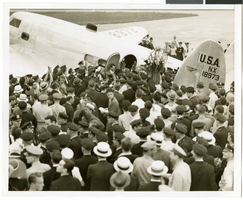
Photograph of Howard Hughes and crowds at Floyd Bennett Airfield, New York, July 14, 1938
Date
1938-07-14
Archival Collection
Description
The black and white view of Howard Hughes and his crew being surrounded by crowds as they exit the Lockheed 14 aircraft after finishing the Around the World flight at Floyd Bennett Airfield in New York.
Image