Search the Special Collections and Archives Portal
Search Results

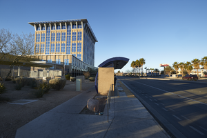
Bus stop in front of the North Las Vegas City Hall building, looking west in North Las Vegas, Nevada: digital photograph
Date
Archival Collection
Description
From the UNLV University Libraries Photographs of the Development of the Las Vegas Valley, Nevada (PH-00394). Part of the collection documents the entire 19 mile length of the north/south Eastern Avenue / Civic Center Drive alignment. This photograph was captured in the section of Civic Center Drive between Las Vegas Boulevard and Lake Mead Boulevard.
Image

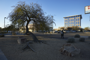
Landscaping in front of North Las Vegas City Hall building and Walgreens, looking west in North Las Vegas, Nevada: digital photograph
Date
Archival Collection
Description
From the UNLV University Libraries Photographs of the Development of the Las Vegas Valley, Nevada (PH-00394). Part of the collection documents the entire 19 mile length of the north/south Eastern Avenue / Civic Center Drive alignment. This photograph was captured in the section of Civic Center Drive between Las Vegas Boulevard and Lake Mead Boulevard.
Image

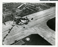
Photograph of the landing of Howard Hughes' Lockheed 14 aircraft, New York, July 14, 1938
Date
Archival Collection
Description
Image
Invoices for distributed film prints, 1931 July 27 to 1931 November 15
Level of Description
Archival Collection
Collection Name: Howard Hughes Film Production Records
Box/Folder: Box 498 (Restrictions apply)
Archival Component

Map of the city of Las Vegas, Nevada, June 1, 1946
Date
Description
Trust Company
Image
Inter-office purchase requests, 1931 July 15 to 1931 September 08
Level of Description
Archival Collection
Collection Name: Howard Hughes Film Production Records
Box/Folder: Box 088 (Restrictions apply)
Archival Component
Statement on Filing for the United States Senate, Carson City, 1982 July 19
Level of Description
Archival Collection
Collection Name: Howard Cannon Papers
Box/Folder: Box 24 (Speeches)
Archival Component
Highlights and Images of Professional Women conference booklet, 1989 July 15
Level of Description
Archival Collection
Collection Name: Nancy Ellen Webb Williams Papers
Box/Folder: Box 01
Archival Component
#05035: Football - UNLV Alumni vs Varsity, 1983 July 15
Level of Description
Archival Collection
Collection Name: University of Nevada, Las Vegas Creative Services Records (1980s)
Box/Folder: N/A
Archival Component

