Search Results
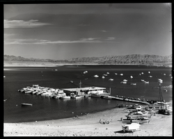
Film transparency of Las Vegas Bay, Lake Mead, Nevada, 1961
Date
Archival Collection
Description
Image
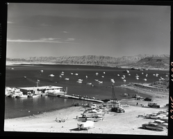
Film transparency of Las Vegas Bay, Lake Mead, Nevada, 1961
Date
Archival Collection
Description
Image
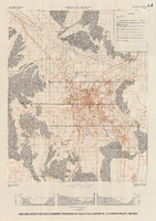
Map and basin profiles showing thickness of valley-fill deposits, Las Vegas Valley, Nevada, 1981 (color variation)
Date
Description
Image
Audio recording clip of interview with Faye Duncan Daniel by Claytee D. White, October 18, 1996
Date
Archival Collection
Description
Part of an interview with Faye Duncan Daniel by Claytee White on October 18, 1996. Daniel discusses the Displaced Homemaker Program and Help Centers of Southern Nevada, which resulted in Women of Achievement.
Sound

Set of photographs including Elder and Sis Blake, and Bishop Cox and Otis Harris
Date
Archival Collection
Description
Photographer's notations: #II-2, copies, Lichses for Elder & Sis Blake, *Bishop Cox & Otis Harris, 7-30-68.
Image
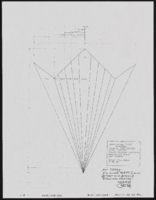
1920s tango unit: specifications and notes
Date
Archival Collection
Description
Series II. Folies-Bergere production papers, designs, and photographs -- 17th Edition: The Best of the Folies-Bergere -- 2002 costume revisions: costume design drawings, photographs of costume pieces, correspondence, and notes -- Flappers/Vamps/Tango
Mixed Content
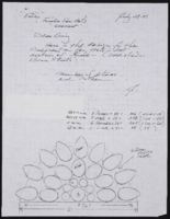
Crescent finale fan hats: correspondence with notes on costume construction
Date
Archival Collection
Description
Series II. Folies-Bergere production papers, designs, and photographs -- 17th Edition: The Best of the Folies-Bergere -- 2001 costume revisions: costume design drawings, photographs of costume pieces, correspondence, and notes -- When I Think of You
Mixed Content
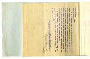

1st and 2nd annual Red Skelton concert at the Sands Hotel: promotional records and photographs
Date
Archival Collection
Description
Series XI. Red Skelton
Sands Hotel and Casino
Mixed Content