Search the Special Collections and Archives Portal
Search Results

Photograph of past, present and future presidents of the North Las Vegas Democratic Club, North Las Vegas, Nevada, circa 1970s
Date
1970 to 1979
Archival Collection
Description
North Las Vegas Democratic Club installations. Pictured L-R: Bonnie Price, outgoing President; Ken Reynolds, past President; Frank Mathews, incoming President. North Las Vegas, circa 1970s.
Image

Photograph of North Las Vegas Chamber of Commerce members during a membership drive, North Las Vegas, Nevada, December 5, 1974
Date
1974-12-05
Archival Collection
Description
North Las Vegas Chamber of Commerce launches membership drive in North Las Vegas, Nevada, December 5, 1974. Pictured L-R Mahlon Faust, Ray Pranske, Keith Farr, Ted Travers, Jack Hon, Wendell Tobler (president), Charles Collins, Al Chandler, Buck McElhone and Warren Holmes.
Image
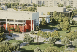
Slide of James R. Dickinson Library, William D. Carlson Education Building and Artemus W. Ham Concert Hall, University of Nevada, Las Vegas, circa 1981-1989
Date
1981 to 1989
Archival Collection
Description
Aerial view of James R. Dickinson Library, William D. Carlson Educaiton Building and Artemus W. Ham Concert Hall, University of Nevada, Las Vegas. The clock tower is seen on the East Mall.
Image

Slide of John Kenneth Galbraith, Marjorie Barrick, William F. Buckley, and Leonard Goodall, Las Vegas, January 10, 1982
Date
1982-01-10
Archival Collection
Description
Economist and author John Kenneth Galbraith (left), Marjorie Barrick (second from left), author and commentator William F. Buckley, Jr. (third from left), and UNLV President Leonard Goodall (at right) at a Barrick Lecture event at the University of Nevada, Las Vegas.
Image

Slide of Fremont Street, Las Vegas, circa late 1950s
Date
1956 to 1959
Archival Collection
Description
An image of automobile traffic on Fremont Street in downtown Las Vegas, looking northwest towards the Union Pacific railroad station. The Golden Nugget and Hotel Apache sign above the Horseshoe Club are visible at the intersection on Second Street. The Lucky Strike Club, Vegas Vic (outside of the Pioneer Club) and Monte Carlo Club are visible on the south side of the street. The corner of the Silver Palace, which opened in May 1956, is visible between the signs for the Boulder Club and Las Vegas Club on the north side of the street.
Image

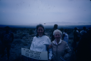
Slide of Sister Rosemary Lynch and Judy Treicher at a Grandmothers for Peace demonstration near the Nevada Test Site, September 13, 1987
Date
1987-09-13
Archival Collection
Description
Color image of Sister Rosemary Lynch (right) standing with Judy Treicher at a Grandmothers for Peace demonstration. Treicher is holding a sign that reads, "Do you hate your enemies more than you love your children?"
Image
Slide of Sister Rosemary Lynch and Judy Treicher at a Grandmothers for Peace demonstration near the Nevada Test Site, September 13, 1987
Date
1987-09-13
Archival Collection
Description
Color image of Sister Rosemary Lynch (right) standing with Judy Treicher at a Grandmothers for Peace demonstration. Treicher is holding a sign that reads, "Do you hate your enemies more than you love your children?"
Image
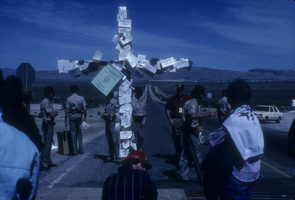
Slide of a large wooden cross covered in paper signs at a demonstration near the Nevada Test Site, March 24, 1989
Date
1989-03-24
Archival Collection
Description
Color image of protesters near a large wooden cross covered in small pieces of paper at a demonstration held on Good Friday against nuclear testing. The names of nuclear tests have been written on the papers and nailed to the cross. Several police officers carrying zip ties are visible in the background.
Image
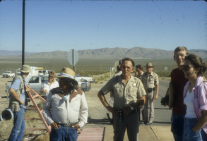
Slide of Bill Rosse, Sheriff Jim Merlino, and others at a demonstration held on Good Friday near the Nevada Test Site, March 24, 1989
Date
1989-03-24
Archival Collection
Description
Color image of Bill Rosse (in hat, with white shirt), a Shoshone Indian, standing with Sheriff Jim Merlino (in uniform). Other law enforcement officers and anti-nuclear testing protesters are also visible.
Image
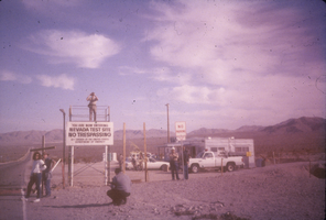
Slide of protesters standing in front of a large wooden cross next to the No Trespassing sign at the Nevada Test Site, March 24, 1989
Date
1989-03-24
Archival Collection
Description
Color image of protesters standing in front of a large wooden cross next to the "No Trespassing" sign marking the entrance to the Nevada Test Site during an anti-nuclear testing demonstration held on Good Friday. A guard is posted at the entrance sign.
Image
Pagination
Refine my results
Content Type
Creator or Contributor
Subject
Archival Collection
Digital Project
Resource Type
Year
Material Type
Place
Language
Records Classification
