Search Results
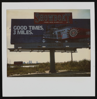
Polaroid of Showboat billboard advertisement, Atlantic City, New Jersey: photographic print
Date
Archival Collection
Description
Image
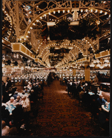
Interior view of Showboat Casino, Atlantic City, New Jersey: photographic print
Date
Archival Collection
Description
Image
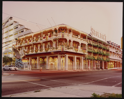
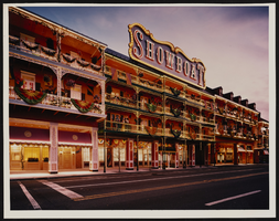
Exterior view of the Showboat Casino, Atlantic City, New Jersey: photographic print
Date
Archival Collection
Description
Image
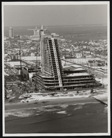
Construction of the Showboat high-rise, Atlantic City, New Jersey: photographic print
Date
Archival Collection
Description
Image
Exterior view of Showboat Casino, Atlantic City, New Jersey: photographic print
Date
Archival Collection
Description
Image
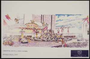
Conceptual sketch of the porte cochere at the Showboat Casino, Atlantic City, New Jersey
Date
Archival Collection
Description
Image
Boulder City Parkway planting plan, 2000 July
Level of Description
Archival Collection
Collection Name: UNLV University Libraries Collection of Architecture Drawings
Box/Folder: Roll 093, Roll 095
Archival Component

Map of California, Utah, Nevada, Colorado, New Mexico and Arizona, circa 1867
Date
Description
Image
Howard Hughes waving to crowds in a parade in Houston, Texas, 1938 July 30
Level of Description
Archival Collection
Collection Name: Howard Hughes Professional and Aeronautical Photographs
Box/Folder: Folder 04
Archival Component
Howard Hughes's around-the-world flight photographs, 1938
Level of Description
Scope and Contents
Materials depict the celebrations of Howard Hughes's circumnavigation flight in 1938. Along with a crew consisting of Harry Connor, Tom Thurlow, Richard Stoddart, and Ed Lund, Hughes flew the Super Electra on a global circumnavigation flight. On July 10, 1938, Hughes and the crew departed Floyd Bennett Field in New York and flew to Paris, France, Moscow, Russia, Omsk, Russia, Yakutsk, Russia, Fairbanks, Alaska, and Minneapolis, Minnesota before landing back in New York on July 14. The photographs primarily depict the parades thrown for Hughes after completion of the flight. The photographs also depict Hughes and his crew meeting with New York City Mayor Fiorello La Guardia at New York City Hall, the National Press Association, and crowds of onlookers who attended the plane's landings in various cities.
Archival Collection
Collection Name: Howard Hughes Public Relations Photograph Collection
Box/Folder: N/A
Archival Component