Search the Special Collections and Archives Portal
Search Results
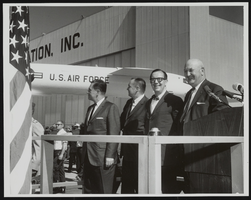
Howard Cannon pictured with an unidentified group: photographic print
Date
1964
Archival Collection
Description
From the Howard Cannon Photograph Collection (PH-00192)
Image
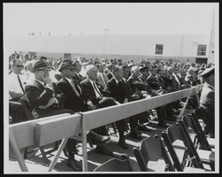
Howard Cannon pictured with an unidentified group: photographic print
Date
1964
Archival Collection
Description
From the Howard Cannon Photograph Collection (PH-00192)
Image
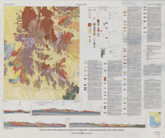
Geologic map of the northeast quarter of the Bullfrog 15-minute quadrangle, Nye County, Nevada, 1990
Date
1990
Description
58 x 46 cm., on sheet 87 x 102 cm., folded in envelope 30 x 24 cm. Relief shown by contours and spot heights. "Contour interval 40 feet." "Base from U.S. Geological Survey 1:62,500. 1954." "Geology mapped in 1985 and 1988." Includes text, bibliography, 4 col. cross sections, and location and index maps. "Prepared in cooperation with the U. S. Atomic Commission." Original publisher: U. S. Geological Survey, Series: Miscellaneous investigations series, map I, Scale: 1:24 000.
Image
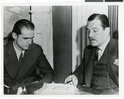
Photograph of Howard Hughes and Grover Whalen, 1938
Date
1938
Archival Collection
Description
Description printed on photograph's accompanying sheet of paper: "Howard Hughes is appointed Aeronautic Adviser to the New York Worlds Fair 1939 by Grover Whalen, its president."
Image
IFSEA New York, New York
Level of Description
File
Archival Collection
International Food Service Executives Association Records
To request this item in person:
Collection Number: MS-00305
Collection Name: International Food Service Executives Association Records
Box/Folder: N/A
Collection Name: International Food Service Executives Association Records
Box/Folder: N/A
Archival Component
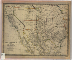
Map of Utah, New Mexico, Texas, California, Indian territory, and the northern states of Mexico, 1852
Date
1852-01-01
Description
At head of title: 'North America, sheet XV.' 'Published under the superintendence of the Society for Diffusion of Useful Knowledge.' At bottom center of map:'London, Charles Knight, Jany. 1st, 1852.' At bottom right of map: ' J. & C. Walker Sculpt.' Scale [1:7,500,000] 1 degree to 68.89 English miles (W 125°--W 92°/N 43°30?--N 22°30?). Relief shown by hachures. Atlas page number in lower margin: 144. Boundaries hand colored. Includes notes, locations of Indian tribes, population statistics. Charles Knight.
Image
Pagination
Refine my results
Content Type
Creator or Contributor
Subject
Archival Collection
Digital Project
Resource Type
Year
Material Type
Place
Language
Records Classification

