Search Results

Interview with Lawrence V. Robinson, November 23, 2004
Date
Archival Collection
Description
Text
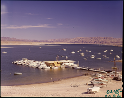
Film transparency of Las Vegas Bay, Lake Mead, Nevada, 1961
Date
Archival Collection
Description
Image
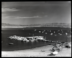
Film transparency of Las Vegas Bay, Lake Mead, Nevada, 1961
Date
Archival Collection
Description
Image
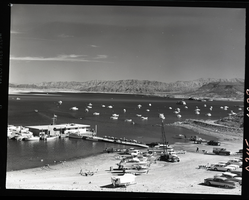
Film transparency of Las Vegas Bay, Lake Mead, Nevada, 1961
Date
Archival Collection
Description
Image
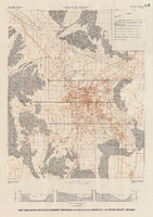
Map and basin profiles showing thickness of valley-fill deposits, Las Vegas Valley, Nevada, 1981 (color variation)
Date
Description
Image
Audio recording clip of interview with Faye Duncan Daniel by Claytee D. White, October 18, 1996
Date
Archival Collection
Description
Part of an interview with Faye Duncan Daniel by Claytee White on October 18, 1996. Daniel discusses the Displaced Homemaker Program and Help Centers of Southern Nevada, which resulted in Women of Achievement.
Sound

Transcript of interview with Oliver Crickman by William Hawley, March 3, 1979
Date
Archival Collection
Description
On March 3, 1979, William Hawley interviewed Oliver Crickman (born 1933 in Apex, North Carolina) about his experiences from living in Nevada and working in restaurants. Crickman first describes his background and his first occupations prior to starting as a cook in Las Vegas restaurants. He then explains how he gradually moved from the position of cook’s helper to sous chef and his then-current position of executive chef at the Royal Inn. Crickman goes into detail about the operation of those restaurants and other Las Vegas Strip and Downtown Las Vegas properties, and he describes the demographics of cooks as well as how the hospitality industry has changed over time. The latter part of the interview involves a discussion of Crickman’s various residences in Las Vegas over time, the extent of crime, the first places to shop, and a brief discussion on mobile homes.
Text

Set of photographs including Elder and Sis Blake, and Bishop Cox and Otis Harris
Date
Archival Collection
Description
Photographer's notations: #II-2, copies, Lichses for Elder & Sis Blake, *Bishop Cox & Otis Harris, 7-30-68.
Image
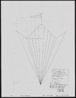
1920s tango unit: specifications and notes
Date
Archival Collection
Description
Series II. Folies-Bergere production papers, designs, and photographs -- 17th Edition: The Best of the Folies-Bergere -- 2002 costume revisions: costume design drawings, photographs of costume pieces, correspondence, and notes -- Flappers/Vamps/Tango
Mixed Content