Search Results
Meeting minutes for Consolidated Student Senate University of Nevada, Las Vegas, March 2, 1998
Date
1998-03-02
Archival Collection
Description
Includes meeting agenda and minutes, and senate bils.
Text
Meeting minutes for Consolidated Student Senate University of Nevada, Las Vegas, February 10, 1997
Date
1997-02-10
Archival Collection
Description
Includes meeting agenda and minutes, along with additional information about a senate bill proposal.
Text
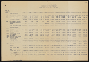
Jewish Federation correspondence, meeting minutes, and other records, item 41
Description
Annual report for the Jewish Federation of Las Vegas, January 1990-June 1991.

Geologic map of Las Vegas Valley, Nevada, 1982
Date
1982
Description
At top of map:'Department of the Interior, U.S. Geological Survey. Prepared in cooperation with the Clark County Department of Comprehensive Planning. Water supply paper 2320-A, plate 1.' At bottom of map: ' Base from U.S. Geological Survey, 1:100,000, Boulder City, Ariz.-Nev., Las Vegas, Nev.-Calif., Mesquite Lake, Nev.-Calif., 1978; Lake Mead, Nev.-Ariz., 1979. Geology from Malmberg (1965); Longwell and others (1965); Haynes (1967); Bingler (1977); Bell and Smith (1980); Bell (1981); Matti and Bachhuber (1982); and Matti and Morton (1982a, b); modified by R. W. Plume, 1981.' Shows township and range lines. Scale 1:100,000 (W 115°30´--W 115°00´/N 36°30´--N 36°00´). Series: U.S. Geological Survey water-supply paper
2320-A. Originally published as plate 1 of Ground-water conditions in Las Vegas Valley, Clark County, Nevada. Part I. Hydrogeologic framework / by Russell W. Plume, published by the U.S. Geological Survey in 1989 as Water-supply paper 2320-A.
2320-A. Originally published as plate 1 of Ground-water conditions in Las Vegas Valley, Clark County, Nevada. Part I. Hydrogeologic framework / by Russell W. Plume, published by the U.S. Geological Survey in 1989 as Water-supply paper 2320-A.
Image

Surficial geologic map of Las Vegas Valley, Nevada, circa 1981
Date
1977 to 1985
Description
'United States Department of the Interior, Geological Survey. Open-file report, 84-130, plate 1.' 'Prepared in cooperation with the Clark County Department of Comprehensive Planning.' 'Base from U.S. Geological Survey 1:100,000, Boulder City, Ariz.-Nev., Las Vegas, Nev.-Calif., Mesquite Lake, Nev.-Calif., 1978, Lake Mead, Nev.-Ariz., 1979.'Geology from Malmberg (1965); Longwell and others (1965); Haynes (1967); Bingler (1977); Bell and Smith (1980); Bell (1981); Matti and Bachhuber (1982); and Matti and Morton (1982a and b); modified by R. W. Plume, 1981.' Shows township and range lines. Scale [ca. 1:102,960. 1 in.=approx. 1.625 miles] (W 115°30´--W 115°00´/N 36°30´--N 36°00´). Series: Open-file report (Geological Survey (U.S.))
84-130. Originally published as plate 1 of Ground-water conditions in Las Vegas Valley, Clark County, Nevada. Part I. Hydrogeologic framework / by Russell W. Plume, published by the U.S. Geological Survey in 1984 as Open-file report 84-130.
84-130. Originally published as plate 1 of Ground-water conditions in Las Vegas Valley, Clark County, Nevada. Part I. Hydrogeologic framework / by Russell W. Plume, published by the U.S. Geological Survey in 1984 as Open-file report 84-130.
Image
Gil Shaw Photograph Collection
Identifier
PH-00396
Abstract
The collection is primarily comprised of photographs shot by photo enthusiast and Congregation Ner Tamid member, Gil Shaw. Photographs primarily depict events such as annual meetings, social events, and High Holy Day services held at and by Congregation Ner Tamid from 2004 to 2014. Also included are photographs depicting the 1983 construction of Congregation Ner Tamid's new campus in Henderson, Nevada.
Archival Collection
Downtown Project Marketing Materials
Identifier
MS-00654
Abstract
The Downtown Project Marketing Materials (2013-2014) are comprised of publications pertaining to the Downtown Project in Las Vegas, Nevada. The collection includes issues of the weekly publication
Archival Collection

Interview with Robert Martin "Doc" Campbell, Jr., March 12, 2005
Date
2005-03-12
Archival Collection
Description
Narrator affiliation: Atomic Veteran, U.S. Navy
Text