Search the Special Collections and Archives Portal
Search Results
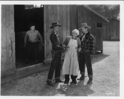
Rex Bell in movie still from unidentified movie: photographic print
Date
1880 to 1979
Archival Collection
Description
Dorothy Bell Scans UNLV-Public Lands Institute
Image
Audio recording clip of interview with NDE Immersion Group by Suzanne Becker, January 13, 2006
Date
2006-01-13
Archival Collection
Description
Narrator affiliation: Peace Studies, Nevada Desert Experience
Sound
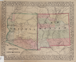
Map of Arizona and New Mexico, 1867
Date
1867
Description
26 x 32 cm. Relief shown by hachures. "Entered according to act of Congress in the year 1867 by S. Augustus Mitchell in the Clerks Office of the District Court for the Eastern District of Pennsylvania." Includes decorative border of grape vines. Shows Tucson as capital of Arizona; shows various trails including Cook's Wagon Route, Marcy's Route, and Kearney's Route. Written in pencil in lower right corner: 135. Original publisher: S.A. Mitchell.
Image
Audio recording clip of interview with Zenna Mae and Eugene Bridges by Mary Palevsky, November 19, 2004
Date
2004-11-19
Archival Collection
Description
Narrator affiliation: Downwinder (Salt Lake City, Utah)
Sound
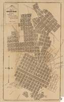
Map of Goldfield, Nevada, April 25, 1907
Date
1907-04-25
Description
'Compiled by James H. Parks, U.S. Deputy Min. Sur., Box 655, Goldfield, Nev. April 25, 1907.' 'Nevada Press Company, Carson City, Nevada.' Scale: [ca. 1:4,800] 1 inch = 400 ft. Plat map. Library's copy has notes handwritten in pencil along right margin with arrows to locations on map: "Ramsey Street ended Columbia St." "MacMaskrs office." "Lived on Euclid ave in adobe house." " Lived in Tent House Sundog Ave."
Image

Map of the city of Las Vegas, North Las Vegas, "the Strip," 1960
Date
1960
Description
1960 edition. 41 x 43 cm. Copyright held by Robert E. Barringer. Title in upper-right corner of map: Las Vegas area map. Irregularly-shaped map. Includes index, notes, list of Las Vegas schools and inset maps of East Las Vegas (Whitney) and Wherry housing area on Nellis Air Force Base. Original publisher: Redwood Publishing Co..
Image
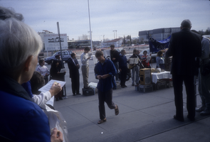
Slide of protesters at a prayer vigil outside of the Las Vegas Federal Building, January 13, 1991
Date
1991-01-13
Archival Collection
Description
Color image of anti-nuclear testing protesters at a prayer vigil held outside of the Las Vegas Federal Building.
Image
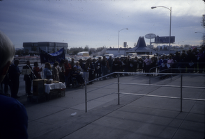
Slide of protesters at a prayer vigil outside of the Las Vegas Federal Building, January 13, 1991
Date
1991-01-13
Archival Collection
Description
Color image of anti-nuclear testing protesters at a prayer vigil held outside of the Las Vegas Federal Building.
Image
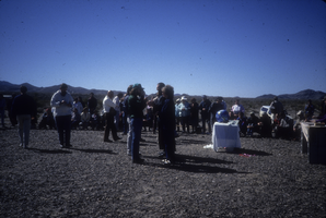
Slide of protesters at a demonstration near the Nevada Test Site, March 8, 1991
Date
1991-03-08
Archival Collection
Description
Color image of people involved with the Lenten Desert Experience (also called the Nevada Desert Experience), a group demonstrating against nuclear testing, gathered in the Nevada desert.
Image
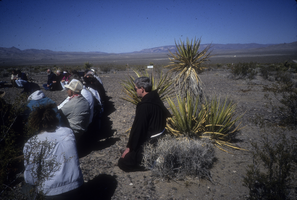
Slide of protesters at a demonstration near the Nevada Test Site, March 8, 1991
Date
1988 to 1991
Archival Collection
Description
Color image of people involved with the Lenten Desert Experience (also called the Nevada Desert Experience), a group demonstrating against nuclear testing, gathered in the Nevada desert.
Image
Pagination
Refine my results
Content Type
Creator or Contributor
Subject
Archival Collection
Digital Project
Resource Type
Year
Material Type
Place
Language
Records Classification
