Search the Special Collections and Archives Portal
Search Results
Members of the Howard Hughes around-the-world flight: Thomas Thurlow, navigator; Richard Stoddart, radio engineer; Ed Lund, mechanic; and H. P. Connor, co-navigator, as they rode in the welcoming parade in New York City, 1938 July 15
Level of Description
File
Archival Collection
Howard Hughes Public Relations Photograph Collection
To request this item in person:
Collection Number: PH-00373
Collection Name: Howard Hughes Public Relations Photograph Collection
Box/Folder: Folder 10
Collection Name: Howard Hughes Public Relations Photograph Collection
Box/Folder: Folder 10
Archival Component
Henderson City Hall. Contains memos, list and appeals, 1975 March
Level of Description
File
Archival Collection
Howard Cannon Papers
To request this item in person:
Collection Number: MS-00002
Collection Name: Howard Cannon Papers
Box/Folder: Box 05 (Las Vegas files)
Collection Name: Howard Cannon Papers
Box/Folder: Box 05 (Las Vegas files)
Archival Component
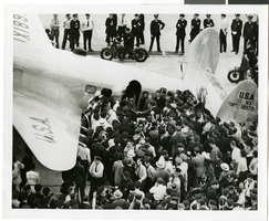
Photograph of Howard Hughes and crowds at Floyd Bennett Airfield, New York, July 14, 1938
Date
1938-07-14
Archival Collection
Description
The black and white view of Howard Hughes and his crew being surrounded by crowds as they exit the Lockheed 14 aircraft after finishing the Around the World flight at Floyd Bennett Airfield in New York.
Image
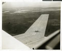
Photograph of the landing of Howard Hughes' Lockheed 14 aircraft, New York, July 14, 1938
Date
1938-07-14
Archival Collection
Description
The black and white, aerial view of Howard Hughes' Lockheed 14 aircraft performing its final landing on the Round the World flight at Floyd Bennett Airport, New York.
Image
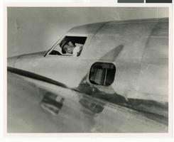
Photograph of Howard Hughes in the cockpit of a Lockheed-14 plane, New York, July 10, 1938
Date
1938-07-10
Archival Collection
Description
Howard Hughes in cockpit of Lockheed-14 before take-off from Floyd Bennet Field in New York.
Image
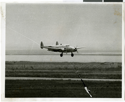
Photograph of the landing of Howard Hughes' Lockheed 14 aircraft, New York, July 14, 1938
Date
1938-07-14
Archival Collection
Description
The black and white, aerial view of Howard Hughes' Lockheed 14 aircraft performing its final landing on the Round the World flight in Floyd Bennett Airport, New York. Typed onto a piece of paper attached to the image: "Howard Hughes ready to land at Floyd Bennett Airport."
Image
Watercolor sketches: Central Park, New York City, New York, undated
Level of Description
File
Archival Collection
Jeanne Russell Janish Papers
To request this item in person:
Collection Number: MS-00355
Collection Name: Jeanne Russell Janish Papers
Box/Folder: Oversized Box 16
Collection Name: Jeanne Russell Janish Papers
Box/Folder: Oversized Box 16
Archival Component
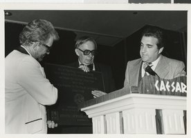
Wilbur Clark at a formal dinner, New York City, New York, 1958
Level of Description
File
Archival Collection
Toni and Wilbur Clark Photographs
To request this item in person:
Collection Number: PH-00302
Collection Name: Toni and Wilbur Clark Photographs
Box/Folder: Folder 10
Collection Name: Toni and Wilbur Clark Photographs
Box/Folder: Folder 10
Archival Component
Pagination
Refine my results
Content Type
Creator or Contributor
Subject
Archival Collection
Digital Project
Resource Type
Year
Material Type
Place
Language
Records Classification
