Search the Special Collections and Archives Portal
Search Results
Gertrude and Roosevelt Toston Photograph Collection
Identifier
Abstract
The Gertrude and Roosevelt Toston Photograph Collection is comprised of digital surrogates of photographic prints, slides, and ephemera documenting Gertrude and Roosevelt Toston's lives in Las Vegas, Nevada from 1958 to 2002. The collection mainly documents Roosevelt Toston's career as a newscaster for KLAS-TV and Gertrude Toston's involvement with the Delta Sigma Theta Sorority. Other images in this collection include photographs of Roosevelt Toston's childhood home in Epps, Louisiana and photographs of Gertrude Toston with her stepfather, Reverend Leo A. Johnson.
Archival Collection
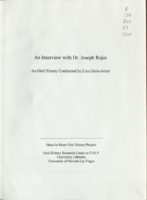
Transcript of interview with Dr. Joseph Rojas by Lisa Gioia-Acres, September 30, 2008
Date
Archival Collection
Description
Dr. Joseph Rojas, born 1933 in Alexandria, Louisiana, was the son of Joseph Edward Rojas and wife Carroll. He graduated high school at age 16 and entered Loyola University of the South. Two years later he was accepted at Louisiana State University School of Medicine, graduating with a medical degree in 1957. He interned at Charity Hospital and then completed his OB-GYN residency at Tulane University. Several mentors worked with Dr. Rojas during his residency and he recalls learning surgical and bed-side skills from the likes of Dr. Lynn White and Dr. Fred Janson. He also remembers the very high volume of patients - up to 300 - that he and other residents saw daily. Dr. Rojas married Mona Robicheaux, RN, during his residency and afterwards joined the Air Force. He and his family — they eventually had six children — were stationed at Nellis Air Force Base, arriving in Las Vegas in 1961. He was chief of OBGYN and deputy hospital commander while at Nellis and then served as chief of OBGYN at Southern Nevada Memorial Hospital until 1972. He later served as chief of staff at Women's Hospital and Valley Hospital, and was the first chief of staff at Summerlin Hospital. Dr. Rojas also maintained a private practice outside of the hospital. His wife worked alongside him in his office, and they share memories and anecdotes of the patients they saw and the general atmosphere of the medical community. Both Joseph and Mona agree that Las Vegas hospitals were less racially segregated than the hospitals in Louisiana, and felt that the West was more open to integration. In 1966 Dr. Rojas started the first OB-GYN residency in Nevada, which led to the development of the University of Nevada School of Medicine. He was a researcher, lecturer, teacher, and author. He earned many awards, including the Harold Feikes MD Award for Outstanding Physician in Clark County (2001), and the Nevada State Medical Association Distinguished Physician Award (1980). Dr. Rojas passed away in May of 2009, leaving behind an incredible legacy of service to the residents of Clark County.
Text
Edgar Flores (Nevada Legislature, Assemblyman) oral history interview conducted by Magdalena Martinez and Facundo Bentancourt: transcript
Date
Archival Collection
Description
From the Lincy Institute "Perspectives from the COVID-19 Pandemic" Oral History Project (MS-01178) -- Elected official interviews file.
Text
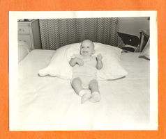
Rex Bell and Clara Bow Bell's son, George Bedlam, Jr.: photographic print
Date
Archival Collection
Description
Bell Family Scrapbook scanning, Set 4, proofed 11.04.2010 George Francis Robert Bell infant photograph. Location unknown
Image
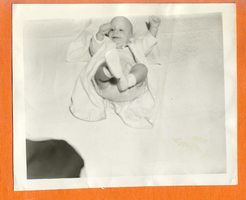
Rex Bell and Clara Bow Bell's son, George Bedlam, Jr.: photographic print
Date
Archival Collection
Description
Bell Family Scrapbook scanning, Set 4, proofed 11.04.2010 George Francis Robert Bell infant photograph. Location unknown
Image
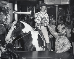
Photograph of a man sitting on a horse amid a group of people at a Union Pacific Old Timer's Club gathering at the Fremont Hotel, Las Vegas, circa 1940
Date
Archival Collection
Description
Image
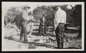
Two women and two men around a campfire at Panaca Summit, Nevada: photographic print
Date
Archival Collection
Description
Image


