Search the Special Collections and Archives Portal
Search Results
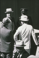
Slide of Franklin D. Roosevelt, Harold Ickes, and Key Pittman at Hoover Dam September 30, 1935
Date
1935-09-30
Archival Collection
Description
Black and white image of President Roosevelt, his aide Harold Ickes, and Senator Key Pittman at Hoover Dam's dedication. Note: Boulder Dam was officially renamed Hoover Dam in 1947.
Image
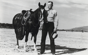
Photograph of George Malone posing beside Gimick the horse, Nevada, circa 1947-1959
Date
1947 to 1959
Archival Collection
Description
Senator George Malone standing next to Gimick the horse in the desert in Nevada. The postcard caption reads: "Senator Malone and "Gimick," one of the top roping and dogging horses west of the Rockies. Gimick has to stand on his tiptoes to be 14 " hands high-weighs 1,050 pounds and on the "getaway" the third jump he is going as fast as he is ever going to go. The Senator gets a calf about every second or third throw."
Image
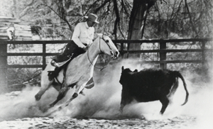
Photograph of George Malone riding his horse PAYDIRT, circa 1947-1959
Date
1947 to 1959
Archival Collection
Description
Senator George Malone riding his horse PAYDIRT in what could possibly be Nevada. The postcard caption reads, "Senator Malone up on his "Cutting horse PAYDIRT" - the little Quarter horse mare stands 14 " hands high and weighs 1,050 pounds. PAYDIRT- a top competitor in any company- is cream colored buckskin with blue stripe down her back."
Image
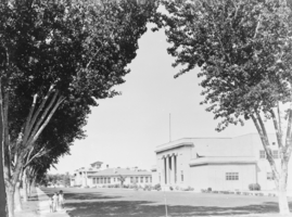
Film transparency of the Las Vegas Grammar School and Las Vegas High School, Las Vegas, Nevada, 1931
Date
1931
Archival Collection
Description
Center: the Las Vegas Grammar School, built in 1911, and demolished between 1964-1965; Right: the Las Vegas High School, built in 1917, was burned May 11, 1934. The photo was taken in 1931.
Image
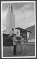
Photograph of Gary Meyer and Mary Kincaid, North Las Vegas, March 2, 1983
Date
1983-03-02
Archival Collection
Description
Gary Meyer, Principal of Faith Lutheran High School, and Mary Kincaid, Chairman of the School board, standing in front of the Faith Lutheran High School in North Las Vegas, Nevada. They are "kicking off" ticket sales for a benefit performance for the school. Individual creators credit goes to Ken Bouton.
Image
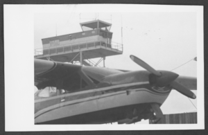
Photograph of a plane and the control tower at the North Las Vegas Air Terminal, North Las Vegas, Nevada, circa late 1960s
Date
1965 to 1969
Archival Collection
Description
A view of the control tower at the North Las Vegas Air Terminal, North Las Vegas, Nevada, circa late 1960s.
Image
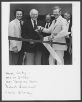
Photograph of the ribbon cutting ceremony for the Edgerton, Germeshausen, & Grier general technical services building, North Las Vegas, Nevada, August 11, 1981
Date
1981-08-11
Archival Collection
Description
The ribbon-cutting for ceremony for the Edgerton, Germeshausen, & Grier general technical services building, North Las Vegas, Nevada, August 11, 1981. Pictured L-R: Manny Cortez; Mahlon Gates; Ray Duncan, Department of Energy; Robert Hammon; Jack Storey.
Image
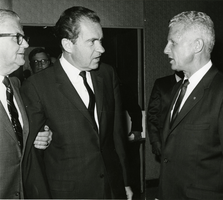
Photograph of Richard Nixon, William L. Taylor and John Gleason, Las Vegas, circa 1969-1974
Date
1969 to 1974
Archival Collection
Description
From left to right, John Gleason, the National Director Boys Clubs of America; President Richard M. Nixon; and Mayor of North Las Vegas William L. Taylor in Las Vegas, Nevada.
Image
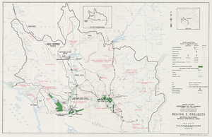
Map of Region 3 projects, Arizona-California-Nevada-New Mexico-Utah, September 1967
Date
1967-09
Description
25 x 39 cm. United States, Department of the Interior, Bureau of Reclamation. Relief shown pictorially. "Map no. X-300-738." "September 1967." Shows completed, under construction and proposed dams and reservoirs, canals, and aqueducts, power plants, pumping plants, substations, transmission lines, tunnels and siphons. Also shows non-Bureau of Reclamation dams, reservoirs, tunnels, pipelines and irrigated lands. Includes inset map of location of Region 3 and key map of drainage basins. Original Publisher: Interior.
Image
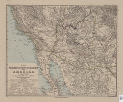
Map of Southwestern United States of America, 1888
Date
1888
Description
33 x 41 cm. Relief shown by hachures and spot heights. 1 sheet of a 6-sheet map. "Petermann: ver. st. v. am. bi. 4". "Stieler's Hand Atlas, No. 86." Binder's title of Hand Atlas über alle Thiele der Erde und über das Weltgebäude, which was published in 1879. In German. Revised 1889. "Neubearbeitret v. H. Habenicht." Original publisher: Justus Perthes, Scale: 1:3,700,000.
Image
Pagination
Refine my results
Content Type
Creator or Contributor
Subject
Archival Collection
Digital Project
Resource Type
Year
Material Type
Place
Language
Records Classification
