Search Results
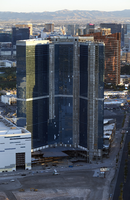
The Fountainbleau from above, Las Vegas, Nevada: digital photograph
Date
2017-05-18
Archival Collection
Description
The unfinished Fountainbleau project sits on the north end of the Las Vegas Strip as seen from the Stratosphere Tower. The three-billion dollar project that began in 2007, fell on hard times and at 70% completion has been left untouched.
Image

Aerial photograph of Lake Mead Lodge, Boulder City (Nev.), 1940s-1950s
Date
1940 to 1959
Archival Collection
Description
Aerial view of Lake Mead Lodge. Site Name: Lake Mead Lodge (Boulder City, Nev.) Street Address: 322 Lakeshore Road, Boulder City, Clark County, NV
Image
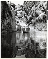
Photograph of the Hae Dae boat, Lake Mead,1940s-1950s
Date
1940 to 1959
Archival Collection
Description
Several tourists on board the "Hae Dae" boat, smiling in a cove in Lake Mead. On the side of the boat is the name of the boat, "Hae Dae", and the identification, "27F638."
Image
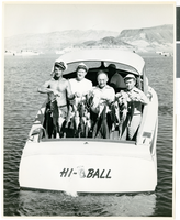
Photograph of fishermen with their catch, Lake Mead, 1940s-1950s
Date
1940 to 1959
Archival Collection
Description
This picture depicts four unidentified fishermen with the numerous amount of fish they caught that day on Lake Mead. In the front of the boat there is an unidentified individual steering the boat. Written on the back of the boat is the word, "Hi-Ball."
Image

Photograph of fisherman and his catch, Lake Mead, 1940s-1950s
Date
1945 to 1959
Archival Collection
Description
An unidentified individual is fishing on Lake Mead. In on hand he is holding a fishing rod. In his other hand he is holding two fish that he caught on Lake Mead.
Image
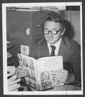
Photograph of Dr. Ralph Roske, Las Vegas, 1979
Date
1979
Archival Collection
Description
A picture of University of Nevada, Las Vegas History Professor Dr. Ralph Roske in his office space.
Image
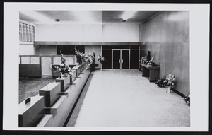
Interior of new Bank of Nevada: photographic print
Date
1958-11-09
Archival Collection
Description
Historic Events in Henderson's History. Interior of new Bank of Nevada, Henderson, Nevada. (Opened February 8, 1954.)
Image