Search Results
Photograph of black law enforcement officers, 2000
Date
Archival Collection
Description
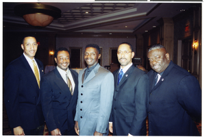
(L-R) Charles Hank (Captain, Metro); Vic Dunn (Deputy Chief, North Las Vegas police); Greg Boyakins (Postal Inspector); Greg McCurdy (Las Vegas Metro); Chuck Mangrum (retired Lt., Metro)
Image

Photograph of Cliff Davis, Janet Reno and Greg McCurdy, circa 1998
Date
Archival Collection
Description
Greg McCurdy (far right) with Metro Deputy Chief Cliff Davis and US Attorney General Janet Reno at a Las Vegas event.
Image
Photograph of Greg McCurdy (right) and Sheriff Jerry Keller, 2002
Date
Archival Collection
Description
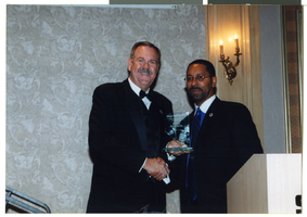
Greg McCurdy and Sheriff Jerry Keller with his Lloyd Sealy Award at a National Organization of Black Law Enforcement Executives [NOBLE] meeting in 2002.
Image

Photograph Greg McCurdy speaking at the Las Vegas Counterterrorism Awareness Workshop, 2013
Date
Archival Collection
Description
Greg McCurdy speaking at 2013 Las Vegas Counterterrorism Awareness Workshop
Image
Newspaper clipping, LV authorities urge Nevadans to be watchful, Las Vegas Review-Journal, September 10, 2011
Date
Archival Collection
Description
Newspaper clipping from the Las Vegas Review-Journal regarding local preparations for the tenth anniversary of 9/11 attacks.
Text
Newspaper clipping, Sheriff heading for Middle East for talks on global crime trends, Las Vegas Review-Journal, n.d.
Date
Archival Collection
Description
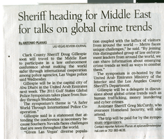
Las Vegas Review Journal article about a Middle East law enforcement conference attended by Clark County Sheriff Doug Gillespie and Assistant Sheriff Greg McCurdy.
Text
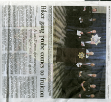
Newspaper clipping, Biker gang probe comes to fruition, Las Vegas Review-Journal, June 28, 2013
Date
Archival Collection
Description
Article about arrests that occurred from Operation Pure Luck; Assistant Sheriff Greg McCurdy pictured at news conference.
Text
Torjman, David
David Torjman was born March 4, 1939 and raised in Fez, Morocco and was educated in trades at the ORT Vocational School. He then studied at Sunderland Talmudical College in England before immigrating to the United States. In 1964, he was recruited to teach at Temple Beth Sholom. Soon after, Torjman met Iris Schwartz who had moved to Las Vegas, Nevada to live with her aunt. Less than two years later, they had a New York wedding and then a local wedding thrown by the Sisterhood at Temple Beth Sholom. Torjman was a Hebrew school teacher until 1975.
Person
Lillian Morrison interview, 1996: transcript
Date
Archival Collection
Description
Lillian Morrison was the first uniformed female who worked for Park Service and has worked for Reclamation for 20 years during the war at Camp Williston. Morrison recalls life in Boulder City during the late 1930s and 1940s. Morrison is the wife of Lloyd Shorty Morrison.
Text
Russell K. Grater interview, March 15, 1995: transcript
Date
Archival Collection
Description
Interviewed by Dennis McBride; work with National Park Service including time at the Lake Mead National Recreation Area
Text