Search the Special Collections and Archives Portal
Search Results
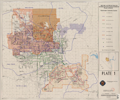
Map showing plan for water quality management update for wastewater collection systems in the Las Vegas Valley, February 20, 1997
Date
1997-02-20
Description
'Plate 1. Source: Clark County Geographic Information Systems Central Repository. Comprehensive Planning, Advanced Planning Division. Feburary 20, 1997.' Scale [ca. 1:95, 040. 1 in.=approx. 1.5 miles]. Shows sewers, force mains, service area boundaries, watershed boundaries, and lift stations. Includes inset location map. Includes township and range grid. Clark County, Nevada, Comprehensive Planning, Advanced Planning Division.
Image
Bryan, J. Phileas Fogg and the Jumping Frog: a collection of wild, weird bets, historical and fictional, Holiday 40(2), 1966 August
Level of Description
File
Archival Collection
UNLV Libraries Collection of Articles on Gaming and Las Vegas, Nevada Topics
To request this item in person:
Collection Number: MS-00626
Collection Name: UNLV Libraries Collection of Articles on Gaming and Las Vegas, Nevada Topics
Box/Folder: Box 09
Collection Name: UNLV Libraries Collection of Articles on Gaming and Las Vegas, Nevada Topics
Box/Folder: Box 09
Archival Component

Brochure from Berkley Square Historic District: 1st of Its Kind
Date
2013-02-09
Archival Collection
Description
Community brochure produced by City of Las Vegas to commemorate the National Historic District designation.
Text
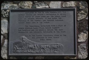
Slide of a historic marker, Virginia City, Nevada, circa 1960s
Date
1960 to 1969
Archival Collection
Description
A picture of a historic marker near Virginia City with details about the revitalization of the city.
Image
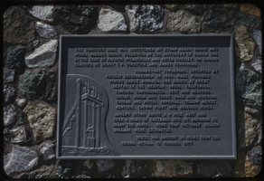
Slide of a historic marker, Virginia City, Nevada, circa 1960s
Date
1960 to 1969
Archival Collection
Description
A picture of a historic marker near Virginia City with details about the revitalization of the city.
Image
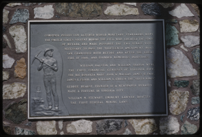
Slide of a historic marker, Virginia City, Nevada, circa 1960s
Date
1960 to 1969
Archival Collection
Description
A picture of a historic marker near Virginia City with details about the revitalization of the city and Comstock Lode.
Image

Slide of a historic marker, Virginia City, Nevada, circa 1960s
Date
1960 to 1969
Archival Collection
Description
A picture of a historic marker near Virginia City with details about the revitalization of the city and Comstock Lode.
Image
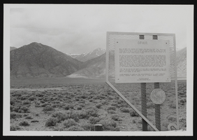
Historical marker, Ophir, Nevada: photographic prints
Date
1974
Description
From the Nan Doughty Photograph Collection (PH-00240). Historical marker in Ophir, Nevada.
Image
National Trust for Historic Preservation
Level of Description
File
Archival Collection
Sheilagh Brooks Collection on Nevada Historical Sites and Museums
To request this item in person:
Collection Number: MS-00280
Collection Name: Sheilagh Brooks Collection on Nevada Historical Sites and Museums
Box/Folder: N/A
Collection Name: Sheilagh Brooks Collection on Nevada Historical Sites and Museums
Box/Folder: N/A
Archival Component
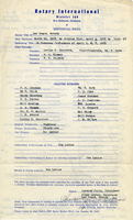
Las Vegas Rotary Club Historical Data
Date
1949 to 1950
Archival Collection
Description
Historical data for the Las Vegas Rotary Club. Chartered March 15, 1923. Signed by Leonard Fayle, President (1949-1950) and Allye Lawson, Secretary. On the back of the page are handwritten notes about the members.
Text
Pagination
Refine my results
Content Type
Creator or Contributor
Subject
Archival Collection
Digital Project
Resource Type
Year
Material Type
Place
Language
Records Classification
