Search Results
Children dressed up in costumes, possibly for the 4th of July at City Hall in Boulder City, Nevada, undated
Level of Description
File
Archival Collection
L. F. Manis Photograph Collection
To request this item in person:
Collection Number: PH-00100
Collection Name: L. F. Manis Photograph Collection
Box/Folder: Folder 67
Collection Name: L. F. Manis Photograph Collection
Box/Folder: Folder 67
Archival Component
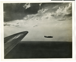
Central Park, New York City, New York: panoramic photograph, 1981 May 31
Level of Description
Item
Archival Collection
Bob Paluzzi Panoramic Photographs
To request this item in person:
Collection Number: PH-00414
Collection Name: Bob Paluzzi Panoramic Photographs
Box/Folder: Box 07, Digital File 00
Collection Name: Bob Paluzzi Panoramic Photographs
Box/Folder: Box 07, Digital File 00
Archival Component
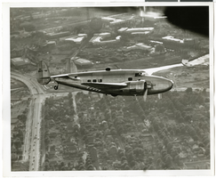
Photograph of the Lockheed 14 aircraft over New York City, July 1938
Date
1938-07
Archival Collection
Description
The black and white view of Howard Hughes plane in flight over New York City, July 1938
Image
Photograph of the Lockheed 14 aircraft over New York City, July 1938
Date
1938-07
Archival Collection
Description
The black and white view of Howard Hughes plane in flight over New York City, July 1938
Image
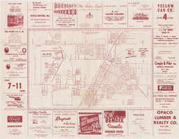
Map of the city of Las Vegas, 1953
Date
1953
Description
24 x 38 cm. on sheet 43 x 56 cm., folded to 28 x 13 cm. Includes advertisements for Las Vegas businesses. Advertisements for Las Vegas businesses, inset map of North Las Vegas, and index on verso. Copyright held by Redwood Pub. Co. Includes inset map of the Strip (U.S. 91 or Los Angeles Highway). Map is irregularly shaped. Original publisher: Redwood Pub. Co..
Image
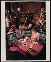
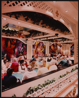
Restaurant in the Showboat Casino, Atlantic City, New Jersey: photographic print
Date
1986
Archival Collection
Description
From the Showboat Atlantic City Photograph Collection (PH-00329).
Image
Gamblers in the Showboat Casino, Atlantic City, New Jersey: photographic print
Date
1986
Archival Collection
Description
From the Showboat Atlantic City Photograph Collection (PH-00329).
Image