Search Results
Las Vegas Convention Center: East Hall expansion, 1975 October 15; 1977 April 1
Level of Description
Archival Collection
Collection Name: JMA Architecture Studio Records
Box/Folder: Roll 24
Archival Component
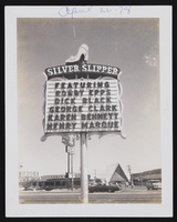
The Silver Slipper Gambling Hall marquee located in Las Vegas, Nevada: photographic prints
Date
Archival Collection
Description
Image
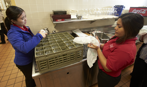
Students working in the Capstone Cafe inside Beam Hall on November 27, 2013: digital photographs
Date
Archival Collection
Description
Image
College of Engineering Honors Convocation held in the Great Hall on April 18, 2013: digital photographs
Date
Archival Collection
Description
Image
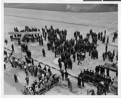
Photograph of a crowd awaiting the arrival of Howard Hughes' plane at Floyd Bennett Airport, New York, July 14, 1938
Date
Archival Collection
Description
Image
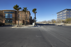
The TruCare Medical building on North McDaniel Street with City Hall, looking west in North Las Vegas, Nevada: digital photograph
Date
Archival Collection
Description
From the UNLV University Libraries Photographs of the Development of the Las Vegas Valley, Nevada (PH-00394). Part of the collection documents the entire 19 mile length of the north/south Eastern Avenue / Civic Center Drive alignment. This photograph was captured in the section of Civic Center Drive between Las Vegas Boulevard and Lake Mead Boulevard.
Image
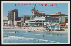
Bally's Park Place, Convention Hall, and other casinos in Atlantic City, New Jersey: postcard
Date
Archival Collection
Description
Image
Report on flood in Meadow Valley Wash, March 3rd to 5th inclusive, March 12, 1938
Date
Archival Collection
Description
Summary of the damage from a flood in the Moapa Valley on March 3-5, 1938
Transcribed Notes: Transcribed from handwritten text on pg. 3: "West of the Flood Channel and on west side of Highway except for a few acres west of Highway and East of Channel in Logandale above point where Highway bridge crosses Channel. # 10 acres early vegetables were silted over lightly making them unfit for shipment. About 5-10 acres will need re-leveling. One of the most important aspects of the entire experience, that of the supervisory personnel getting this lesson which could not be learned without just such an object lesson."
Text

Studying outside of the Lied Library, LLB, before it opens and construction on Hospitality Hall: digital photographs
Date
Archival Collection
Description
Image
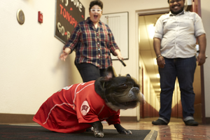
Georgiann Davis, faculty member in residence at Tonopah Hall and her dog Penny: digital photographs
Date
Archival Collection
Description
Image