Search Results

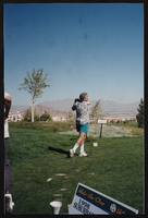
Golf tournament, Culinary Union, Las Vegas (Nev.), 1990s (folder 1 of 4), image 48
Date
1990 to 1999
Description
Arrangement note: Series IV. Internal: Social
Image
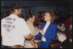
Labor Day banquet, Culinary Union, Las Vegas (Nev.), 1998 (folder 4 of 5), image 5
Date
1998
Description
Arrangement note: Series IV. Internal: Social
Image
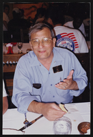
Labor Day banquet, Culinary Union, Las Vegas (Nev.), 1998 (folder 4 of 5), image 59
Date
1998
Description
Arrangement note: Series IV. Internal: Social
Image
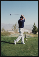
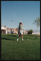
Golf tournament, Culinary Union, Las Vegas (Nev.), 1990s (folder 3 of 4), image 34
Date
1990 to 1999
Description
Arrangement note: Series IV. Internal: Social
Image
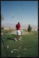
Golf tournament, Culinary Union, Las Vegas (Nev.), 1990s (folder 4 of 4), image 3
Date
1990 to 1999
Description
Arrangement note: Series IV. Internal: Social
Image
Golf tournament, Culinary Union, Las Vegas (Nev.), 1990s (folder 4 of 4), image 10
Date
1990 to 1999
Description
Arrangement note: Series IV. Internal: Social
Image
Golf tournament, Culinary Union, Las Vegas (Nev.), 1990s (folder 4 of 4), image 48
Date
1990 to 1999
Description
Arrangement note: Series IV. Internal: Social
Image
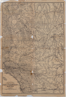
Map of a portion of southern California and southwestern Nevada embracing the arid region of Mojave & Colorado Deserts including Death Valley, circa 1936
Date
1934 to 1938
Description
78 x 52 cm. Relief shown by hachures and spot heights. Panel title: Road map of the Mojave and Colorado Deserts including Death Valley National Monument. In lower right-hand corner: 1379. In lower left-hand corner: Burke-Douglas. Indexes on verso to cities, towns, stations, junctions, resorts and natural features. On verso: Map showing roads and points of interest in Death Valley & vicinity. Originally folded to 27 x 11 cm. Original publisher: The Club.
Image
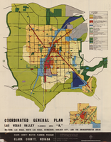
Map showing coordinated general plan for Las Vegas Valley, Planning Area A5, circa 1965-1968
Date
1963 to 1970
Description
Subtitle:'Including Las Vegas, North Las Vegas, Henderson, Boulder City, and the unincorporated areas.' 'Clark County Master Planning Program, Clark County, Nevada.' 'Eisner-Stewart and Associates, Planning Consultants, South Pasadena, California.' Includes inset of Boulder City. Text on verso about the general plan for the Las Vegas Valley, Clark County Master Planning Program Area. Published between 1965 and 1968? Scale [ca. 1:84,269. 1 inch to approximatley 1 1/3 miles].
Text
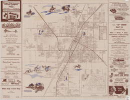
Map of the city of Las Vegas, North Las Vegas, and the "Strip", 1956
Date
1956
Description
40 x 37 cm., folded to 28 x 15 cm. Copyright held by Robert E. Barringer. Panel title: Welcome map, greater Las Vegas area and scenic routes to and from there. Includes inset map of Boulder City. Map of California from San Francisco to Los Angeles to Las Vegas by Beth Bergh on verso. Includes notes. Index on verso. Includes advertisements for Las Vegas and California businesses. Original publisher: Redwood Publishing Co..
Image