Search Results

Map of Argentite: Red Mountain Mining District, Esmeralda County (Nev.),1908
Date
1908
Description
Scale [ca. 1:7,200]. 1 in. equals 600 feet ; 1 map : linen ; 46 x 39 cm
Image
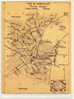
Map of Searchlight Mining District, Clark County (Nev.), 1905
Date
1905
Description
Scale not given ; 1 map ; 61 x 42 cm ; Blueline print ; Shows mineral patents and water rights ;
Image
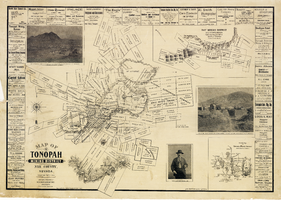
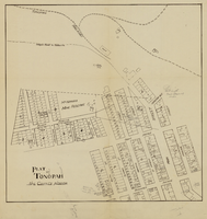
Map of the Tonopah Mining District, Nye County (Nev.), 1902
Date
1902
Description
Map of the Tonopah Mining District, Nye County (Nev.), 1902
Image
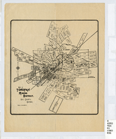
Map of the Tonopah Mining District, Nye County (Nev.), 1903
Date
1903
Description
Scale [ca. 1:7,200]. 1 in. equals 600 feet ; 1 map ; 17 x 16 cm ; Relief shown by hachures ; Library's copy has some mines cross-hatched in pencil ;
Image
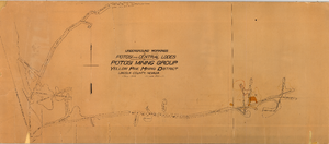
Map of the underground workings in Potosi and Central Lodes of Potosi Mining Group, Lincoln County (Nev.), May, 1906
Date
1906-05
Description
Map of the underground workings in Potosi and Central Lodes of Potosi Mining Group, Lincoln County (Nev.), May, 1906
Image
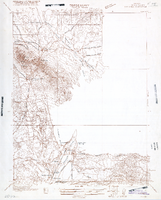
Map of Nevada, Lincoln County, Ely Range Quadrangle, Lincoln County (Nev.), 1921
Date
1921
Description
Map of Nevada, Lincoln County, Ely Range Quadrangle, Lincoln County (Nev.), 1921
Image
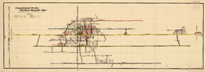
Map of the Longitudinal Section, Montana Tonopah Mine, Nye County (Nev.), 1900-1925
Date
1900 to 1925
Description
Map of the Longitudinal Section, Montana Tonopah Mine, Nye County (Nev.), 1900-1925
Image

Photograph of a woman walking with a child, 1907
Date
1907
Archival Collection
Description
Inscription on front reads "Mio" 1907
Caption: Mio 1907
Caption: Mio 1907
Image