Search Results
#68411: UNLV Public Lands Institute and the Public History graduate studies class holds an open house at Walking Box Ranch outside of Searchlight, NV. December 9, 2011 The Walking Box Ranch is a Bureau of Land Management (BLM) managed historical site and the former home of early movie starlet Clara Bow and her husband Rex Bell. UNLV and PLI are participants in the ranch's development as a historical site through a BLM grant., 2011 December 09
Level of Description
Archival Collection
Collection Name: University of Nevada, Las Vegas Creative Services Records (2010s)
Box/Folder: Digital File 00
Archival Component

Transcript of interview with Martin, Linda, and Robert Wilner by Barbara Tabach, May 10 & 24, 2016
Date
Archival Collection
Description
During the early 1970s, the boom of Las Vegas included many single people following family who had already settled there. Among those was Martin (Marty) Wilner. Marty?s parents were Leo and Mickey Wilner. Leo moved to Las Vegas to become the Executive Director at Temple Beth Sholom, the only synagogue in town. Marty, who was born and raised in California, had recently earned his doctorate in psychology at the University of Houston. He became a counselor at UNLV. Not long after, Marty met Linda at a Jewish Singles event. Linda was a divorced, mother of three children, who had moved from California to find comfort in living near her parents. Robert Wilner is one of her three children. He was adopted by Marty and works with his mother in the real estate business. In this interview, they recall together the Las Vegas of the 1970s. For Robert, he remembers his bar mitzvah, and growing up with Jewish friends under the careful eye of his grandparents. As an adult, he has enjoyed a successful career as a real estate agents working with his mother. For Linda, the success of real estate was being part of one of the most robust housing markets in the country. She and Robert recall an extensive list of visionaries who developed the valley, as well as the inherent challenges of water, unions and maintaining their high level of ethics.
Text
President Herbert Hoover and official party in Tunnel No. 2 during inspection tour of Boulder Canyon Project: Construction Engineer W. R. Young, Bureau of Reclamation; Mr. Ritchey, Secretary to the President; Chief Engineer R. F. Walter, Bureau of Reclamation; Lou Henry Hoover; President Hoover; Marguerite Blake Wilbur; Secretary of the Interior R. L. Wilbur; E. O. Wattis, First Vice-President, Six Companies, Inc.; F. T. Crowe, General Superintendent, Six Companies, Inc., 1932 November 12
Level of Description
Archival Collection
Collection Name: Bureau of Reclamation Photographs of the Hoover Dam and Boulder City, Nevada
Box/Folder: Folder 06 (Restrictions apply)
Archival Component
Union Pacific Railroad supporting infrastructure and facilities: contains station maps, tract maps, and topographic maps throughout Nevada including Las Vegas, Apex, and Lincoln County; also includes and unidentified aerial photographs, calculated capacities of reservoir tanks for Kelso, California Yermo, California, and Las Vegas, Nevada, and architectural and structural drawings from Union Pacific Railroad projects throughout Nevada, 1942 June 04-1959 July 21
Level of Description
Archival Collection
Collection Name: Union Pacific Railroad Collection
Box/Folder: Box 217
Archival Component
Torjman, David
David Torjman was born March 4, 1939 and raised in Fez, Morocco and was educated in trades at the ORT Vocational School. He then studied at Sunderland Talmudical College in England before immigrating to the United States. In 1964, he was recruited to teach at Temple Beth Sholom. Soon after, Torjman met Iris Schwartz who had moved to Las Vegas, Nevada to live with her aunt. Less than two years later, they had a New York wedding and then a local wedding thrown by the Sisterhood at Temple Beth Sholom. Torjman was a Hebrew school teacher until 1975.
Person
Whaley, Eva Poole
Eva Poole Whaley was born on November 22, 1942 in Fordyce, Arkansas. She moved to Las Vegas, Nevada in the early 1960s. She worked in the Clark County School District. She and her husband were restaurant owners before Eva worked at Nevada Power, and then for the telephone company.
Person
Audio clip from interview with Helen Anderson and Karen Walker, February 21, 2014
Date
Archival Collection
Description
Part of an interview with Helen Anderson and Karen Walker, February 21, 2014. In this audio clip, Anderson and Walker (mother and daughter) discuss how their family came to own Hamburger Heaven, and the food they served, including desserts.
Sound
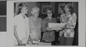
Photographs of donations to Special Collections, Las Vegas, July, 12, 1977
Date
Archival Collection
Description
Image