Search the Special Collections and Archives Portal

Search Results
Display    Results Per Page
Displaying results 23781 - 23790 of 24529

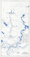
Map and operational diagram, lower Colorado River, Lees Ferry to Gulf of California, June 1973

Date

1973-06

Description

84 x 43 cm. "Map no. 423-300-59." Insets: [Salton Sea]--Operational diagram, no scale. Includes index to gaging stations. Shows dams, canals, levees, pumping plants, etc. "Map compiled from Coast and Geodetic Survey sectional aeronautical charts, and Bureau of Reclamation data." Original publisher: U.S. Dept. of the Interior, Bureau of Reclamation.

Image

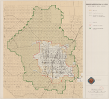
Map showing proposed metropolitan Las Vegas development area, June 24, 1997

Date

1997-06-24

Description

'Data sources: Advanced Planning Division, Clark County, Nevada.' 'Comprehensive Planning, Advanced Planning Division.' 'June 24, 1997.' Shows federal land, metropolitan Las Vegas development area, Las Vegas urban growth boundary and section lines. Scale [ca. 1:154,056. 1 inch to approx. 12,838 feet].

Image

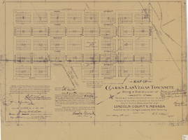
Map of Clark's Las Vegas Townsite, May 8, 1905

Date

1905-05-08

Description

'Book 1, Page 37.' 'Dated: May 8th, 1905.' Subtitle: 'Being a sub-division of parts of the W.1/2 and the W.1/2 of the N.E.1/4 of Section 34 and the S.1/2 of the S.W.1/4 of Section 27 T.20 S.R. 61 E, Mount Diablo Base and Meridian, Lincoln County, Nevada. A Plat map. Blueline print. Scale [ca. 1:2,400]. 1 in. to 200 feet.

Text

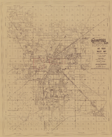
Las Vegas Valley map, Clark County, Nevada, June 1958

Date

1958

Description

'Compiled 1954. First revision - June 1958.' 'Area extends 9 miles north, 11 miles south, and 3 miles east, 3 miles west city limits of Las Vegas.' Original publisher: Campbell Realty. Scale [ca. 1:60,000. 1 in. to approx. 5,000 ft.]. Cadastral map. Hand-drawn red line around some sections on map.

Image

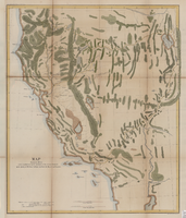
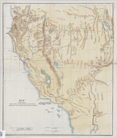
Map showing the different routes travelled over by the detachments of the Overland Command in the spring of 1855 from Salt Lake City, Utah, to the Bay of San Francisco, 1855

Date

1855

Description

57 x 47 cm., folded to 22 x 13 cm. Indicates routes of Capt. Ingalls, Col. Steptoe,and Lt. Mowrey, and shows camping grounds. Relief shown by hachures. Graphic scale given in geographical as well as statute miles. "Ackerman Lith. 319 Broadway, N.Y." Hand colored. Original publisher unknown, Series: House Ex. Doc. No. 1, 1st session, 34th Congress.

Image

Map showing the different routes travelled over by the detachments of the Overland Command in the spring of 1855 from Salt Lake City, Utah, to the Bay of San Francisco, 1855

Date

1855

Description

57 x 47 cm. Indicates routes of Capt. Ingalls, Col. Steptoe, and Lt. Mowrey, and camping grounds. "Ackerman Lith. 319 Broadway, N.Y." Relief shown by hachures. In Wheat, "Mapping of the Trans-Mississippi West", v. 4, p. 210. Library's copy 1 is poor quality and not in color. Original publisher unknown, Series: Senate Ex. Doc. No. 1, 1st session, 34th Congress.

Image

Map of economical features of parts of southern Colorado and northern New Mexico, January 8, 1878

Date

1878-01-08

Description

37 x 49 cm. Relief shown by hachures and spot heights. "Atlas sheet no. 69(B)." "Issued Jan'y 8th 1878." "Expeditions of 1874-1875 & 1877 under the command of 1st. Lieut. Geo. M. Wheeler, Corps of Engineers, U.S. Army." Prime meridians: Greenwich and Washington, D.C. "Weyss, Lang & Herman, del." "By order of the honorable the Secretary of War." "Under the direction of Brig. General A. A. Hunphreys, Chief of Engineers, U. S. Army." Original publisher: U.S. Geographical Surveys West of the 100th Meridian, Scale: 1 inch to 4 miles or 1: 253440.

Image
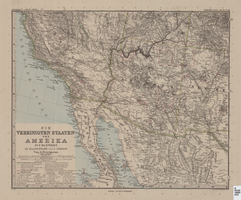
Map of Southwestern United States of America, 1888

Date

1888

Description

33 x 41 cm. Relief shown by hachures and spot heights. 1 sheet of a 6-sheet map. "Petermann: ver. st. v. am. bi. 4". "Stieler's Hand Atlas, No. 86." Binder's title of Hand Atlas über alle Thiele der Erde und über das Weltgebäude, which was published in 1879. In German. Revised 1889. "Neubearbeitret v. H. Habenicht." Original publisher: Justus Perthes, Scale: 1:3,700,000.

Image

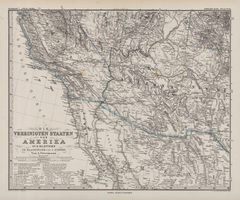
Die Vereinigten Staaten von Amerika in 6 Blättern im Maassstabe von 1:3,700,000

Date

1882

Description

33 x 41 cm. Relief shown by hachures and spot heights. Prime meridian: Greenwich. Sheet 4 of a 6-sheet map. "Petermann: ver. st. v. am. bi. 4". "Stieler's Hand Atlas, No. 86." Binder's title of Hand Atlas über alle Thiele der Erde und über das Weltgebäude, which was published in 1879. In German. Library has only map of Arizona and parts of surrounding states and northern Mexico. Original publisher: Justus Perthes.

Image

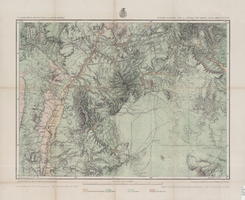
Map of economic features, part of central New Mexico, May 7, 1877

Date

1877-05-07

Description

37 x 50 cm. Relief shown by hachures and spot heights "Atlas sheet no. 77(B)." "Issued May 7th 1877." "Expeditions of 1871 & 1786 under the command of 1st. Lieut. Geo. M. Wheeler, Corps of Engineers, U.S. Army." "Weyss, Herman & Lang, del." "By order of the honorable the Secretary of War." "Under the direction of Brig. General A. A. Hunphreys, Chief of Engineers, U. S. Army." "2nd. Ed. June 30th, 1881." Original publisher: U.S. Geographical Surveys West of the 100th Meridian, Scale: 1 inch to 4 miles or 1: 253440.

Image