Search Results
University of Nevada, Las Vegas Administrative Correspondence Records
Identifier
Abstract
The University of Nevada, Las Vegas (UNLV) Administrative Correspondence Records (1959-1982) primarily contain correspondence from administrative departments, committees, and individuals at UNLV including the Graduate Council, the Assistant to the President, Office of the President, Office of the Academic Vice President, and the Library Committee. The collection includes early documents from when UNLV was established as the southern regional extension of the University of Nevada, and later Nevada Southern University. Additional materials include projections, a room use study, and UNLV 25th Anniversary stickers.
Archival Collection
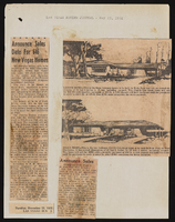
Stratosphere Tower update and tour: video, 1994 March 02
Level of Description
Scope and Contents
KTNV Channel 13 reporter Mark Sayre presents "Tower Trivia"; included are remarks from Stratosphere Tower architect Gary Nelson, project manager Scott Dawes, and construction worker Sandra Lowery; Same clip appears twice. Original media VHS, color, aspect ratio 4 x 3, frame size 720 x 486.
Archival Collection
Collection Name: Bob Stupak Professional Papers
Box/Folder: Digital File 00, Box 35
Archival Component