Search Results

Topographic map of the southeast quadrangle of the metropolitan Las Vegas, Nevada area, 1984
Date
1984
Description
Scale 1:24,000 ; polyconic proj. (W 115°0730--W 115°0000/N 36°0730--N 36°0000) ; 1 map : col. ; 58 x 47 cm ; 7.5 minute series (topographic) ; Relief shown by contours and spot heights ; Filing title: Las Vegas SE, Nev ; "DMA 2956 II SE--Series V896." ; Contour interval 20 feet ; "Topography by photogrammetric methods from aerial photographs taken 1965. Field checked 1967." ; "Revisions shown in purple and woodland compiled from aerial photographs taken 1982 and other sources. This information not field checked. Map edited 1984." ; Includes quadrangle location map ; Interior--Geological Survey
Image

Topographic map of the southeast quadrangle of the metropolitan Las Vegas, Nevada area, 1973
Date
1973
Description
Scale 1:24,000 ; polyconic proj. (W 115°0730--W 115°0000/N 36°0730--N 36°0000) ; 1 map : col. ; 58 x 47 cm ; 7.5 minute series (topographic) ; Relief shown by contours and spot heights ; Filing title: Las Vegas SE, Nev ; "AMS 2956 II SE--Series V896." ; Contour interval 20 feet ; "Topography by photogrammetric methods from aerial photographs taken 1965. Field checked 1967." ; "Revisions shown in purple compiled from aerial photographs taken 1973. This information not field checked." ; Includes quadrangle location map ; Interior--Geological Survey
Image

Topographic map of the southeast quadrangle of the metropolitan Las Vegas, Nevada area, 1967
Date
1967
Description
Scale 1:24,000 ; polyconic proj. (W 115°0730--W 115°0000/N 36°0730--N 36°0000) ; 1 map : col. ; 58 x 47 cm ; 7.5 minute series (topographic) ; Relief shown by contours and spot heights ; Filing title: Las Vegas SE, Nev ; "AMS 2956 II SE--Series V896." ; Contour interval 20 feet ; "Topography by photogrammetric methods from aerial photographs taken 1965. Field checked 1967." ; Includes quadrangle location map ; Interior--Geological Survey
Image

Topographic map of the southwestern quadrangle of the metropolitan Las Vegas, Nevada area, 1973
Date
1973
Description
Scale 1:24,000 ; polyconic proj. (W 115°1500--W 115°0730/N 36°0730--N 36°0000) ; 1 map : col. ; 58 x 47 cm ; 7.5 minute series (topographic) ; Relief shown by contours and spot heights ; Filing title: Las Vegas SW, Nev ; "AMS 2956 II SW--Series V896." ; Contour interval 10 feet ; "Topography by photogrammetric methods from aerial photographs taken 1965. Field checked 1967." ; "Map photoinspected 1973. No major culture or drainage changes observed." ; Includes quadrangle location map ; Interior--Geological Survey
Image

Topographic map of the southwestern quadrangle of the metropolitan Las Vegas, Nevada area, 1967
Date
1967
Description
Scale 1:24,000 ; polyconic proj. (W 115°1500--W 115°0730/N 36°0730--N 36°0000) ; 1 map : col. ; 58 x 47 cm ; 7.5 minute series (topographic) ; Relief shown by contours and spot heights ; Filing title: Las Vegas SW, Nev ; "AMS 2956 II SW--Series V896." ; Contour interval 10 feet ; "Topography by photogrammetric methods from aerial photographs taken 1965. Field checked 1967." ; Includes quadrangle location map ; Interior--Geological Survey
Image

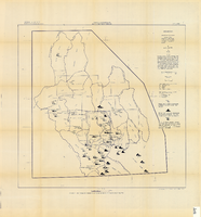
Map of Las Vegas Valley, Clark County, Nevada, 1954
Date
1954
Description
Scale [ca. 1:63,360. 1 in. to approx. 5,280 ft.].Cadastral map. 'Compiled for C.D. Baker, Reg. Civil Engineer Nevada No. 6 and Licensed Real Estate Broker by Tyson Engineering Co., Las Vegas, Nevada.' 'Copyright 1954 Tyson Engineering Co., Las Vegas, Nevada. Drawn by E.M. Ballinger' Tyson Engineering Company
Image

Map showing U.S. Bureau of Reclamation Region 3 projects in Arizona, California, Nevada, New Mexico and Utah, September 1967
Date
1967-09
Description
'United States, Department of the Interior, Stewart L. Udall, Secretary. Bureau of Reclamation, Floyd E. Dominy, Commissioner.' 'Map. No. X-300-738. September 1967.' Scale [ca. 1:1,774,080] (W 119°--W 108°/N 39°--N 32°). Relief shown pictorially. Shows completed, under construction and proposed dams and reservoirs, canals, and aqueducts, power plants, pumping plants, substations, transmission lines, tunnels and siphons. Also shows non-Bureau of Reclamation dams, reservoirs, tunnels, pipelines and irrigated lands. Includes inset map of location of Region 3 and key map of drainage basins. Bureau of Reclamation, [Region 3?].
Image

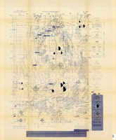
Map of well locations, Las Vegas Valley, Nevada, 1975
Date
1976
Description
'Cartography by Marj Thielke.' 'Prepared in cooperation with the State of Nevada, Department of Conservation and Natural Resources, Division of Water Resources.' Relief shown by contours. Shows township and range lines. Originally published as Plate 1 in Water-level changes associated with ground-water development in Las Vegas Valley, Nevada, 1971-75 : fourth progress report--summary of data / by James R. Harrill, published in 1976 by the Department of Conservation and Natural Resources, Division of Water Resources, as volume 22 of Water resources-information series report. Scale [ca. 1:69,696. 1 in.=approx. 1.1 miles] (W 115°20´--W 115°00´/N 36°20´--N 36°00´).
Image
Map of the Nevada Test Site and vicinity showing principal rock types and chemistry of ground water, 1964
Date
1964
Description
'Compiled by S.L. Schoff and J.E. Moore.' 'Geology generalized from geologic maps of the Nevada Test Site by Special Projects Branch, U.S. Geological Survey; of Lincoln County by Tschanz and Pampeyan (1961); and of Clark County by Bowyer, Pampeyan, and Longwell (1958).' United States Department of the Interior, Geological Survey. Prepared in cooperation with the U.S. Atomic Energy Commission.' 'TEI-838.' Scale 1:125,000 (W 116°00´--W 116°15´/N 37°15´--N 36°30´). Originally published as figure 1 in Chemistry and movement of ground water, Nevada Test Site / by Stuart L. Schoff and John E. Moore, published by the Geological Survey in 1964 as number 838 of the Trace elements investigations report.
Image
Map showing chemical diagrams representing quality of water in Clark and Nye counties, Nevada, 1963
Date
1963
Description
'T.E. Eakin, S.L. Schoff, and P. Cohen, 1963.' 'Department of the Interior, United States Geological Survey, TEI-833.' 'Prepared in cooperation with the U.S. Atomic Energy Commission.' Scale 1:500,000 (W 117°00´--W 115°00´/N 38°30´--N 36°30´). Originally published as figure 3 in Regional hydrology of a part of southern Nevada : a reconnaissance / by Thomas E. Eakin, Stuart L. Schoff, and Philip Cohen, published by the U.S. Geological Survey in 1963 as number 833 of the Trace elements investigation report.
Image