Search Results
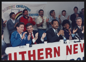
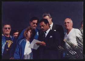
Jesse Jackson press conference, Culinary Union, Las Vegas (Nev.), 1991 December 03 (folder 1 of 1), image 6
Date
1991-12-03
Description
Arrangement note: Series II. Public Events
Image
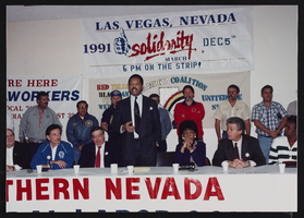
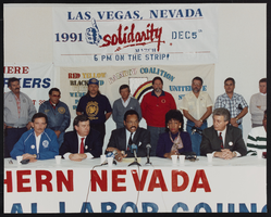
Jesse Jackson press conference, Culinary Union, Las Vegas (Nev.), 1991 December 03 (folder 1 of 1), image 7
Date
1991-12-03
Description
Arrangement note: Series II. Public Events
Image
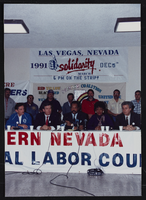
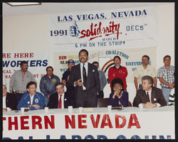
Jesse Jackson press conference, Culinary Union, Las Vegas (Nev.), 1991 December 03 (folder 1 of 1), image 8
Date
1991-12-03
Description
Arrangement note: Series II. Public Events
Image
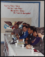
Jesse Jackson press conference, Culinary Union, Las Vegas (Nev.), 1991 December 03 (folder 1 of 1), image 9
Date
1991-12-03
Description
Arrangement note: Series II. Public Events
Image
Jesse Jackson press conference, Culinary Union, Las Vegas (Nev.), 1991 December 03 (folder 1 of 1), image 10
Date
1991-12-03
Description
Arrangement note: Series II. Public Events
Image
Jesse Jackson press conference, Culinary Union, Las Vegas (Nev.), 1991 December 03 (folder 1 of 1), image 11
Date
1991-12-03
Description
Arrangement note: Series II. Public Events
Image
Jesse Jackson press conference, Culinary Union, Las Vegas (Nev.), 1991 December 03 (folder 1 of 1), image 12
Date
1991-12-03
Description
Arrangement note: Series II. Public Events
Image
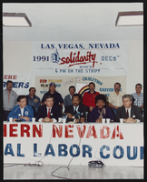
Jesse Jackson press conference, Culinary Union, Las Vegas (Nev.), 1991 December 03 (folder 1 of 1), image 13
Date
1991-12-03
Description
Arrangement note: Series II. Public Events
Image
Jesse Jackson press conference, Culinary Union, Las Vegas (Nev.), 1991 December 03 (folder 1 of 1), image 14
Date
1991-12-03
Description
Arrangement note: Series II. Public Events
Image
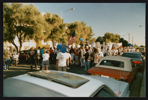
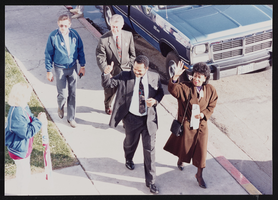
AFL-CIO march with Jesse Jackson, Culinary Union, Las Vegas (Nev.), 1990s (folder 1 of 4), image 62
Date
1990 to 1999
Description
Arrangement note: Series I. Demonstrations, Subseries I.B. Other Demonstrations and Strikes
Image