Search the Special Collections and Archives Portal
Search Results
Holiday Inn Hotel and Casino, Marina Associates:, 1979 November 15; 1980 July 15
Level of Description
Series
Archival Collection
Martin Stern Architectural Records
To request this item in person:
Collection Number: MS-00382
Collection Name: Martin Stern Architectural Records
Box/Folder: N/A
Collection Name: Martin Stern Architectural Records
Box/Folder: N/A
Archival Component

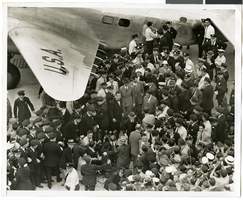
Photograph of crowds at Floyd Bennett Airfield, New York, July 1938
Date
1938-07-14
Archival Collection
Description
The black and white view of Howard Hughes exiting his Lockheed 14 aircraft after performing the final landing on the Round the World flight at Floyd Bennett Airport, New York. Description printed on photograph's accompanying sheet of paper: "Telling the world about the record-smashing flight. New York City--Under the giant wing of the huge Lockheed plane, radio men set up their microphones so that Howard Hughes and his gallant crew of four can send a few words of greeting to the world over the air waves after landing at Floyd Bennett Field on their record-smashing flight around the world. Credit Line (ACME) 7/14/38"
Image
Bodensteiner, Tim, New Vegas, 1982 July 06
Level of Description
File
Archival Collection
Frank Mitrani Photographs
To request this item in person:
Collection Number: PH-00332
Collection Name: Frank Mitrani Photographs
Box/Folder: Box 01
Collection Name: Frank Mitrani Photographs
Box/Folder: Box 01
Archival Component
Stoebling, David, New Vegas, 1982 July 08
Level of Description
File
Archival Collection
Frank Mitrani Photographs
To request this item in person:
Collection Number: PH-00332
Collection Name: Frank Mitrani Photographs
Box/Folder: Box 01
Collection Name: Frank Mitrani Photographs
Box/Folder: Box 01
Archival Component
#67121: Valdex, Jesus (Student) Interns at New York-New York, 2009 July 09
Level of Description
File
Archival Collection
University of Nevada, Las Vegas Creative Services Records (2000s)
To request this item in person:
Collection Number: PH-00388-04
Collection Name: University of Nevada, Las Vegas Creative Services Records (2000s)
Box/Folder: N/A
Collection Name: University of Nevada, Las Vegas Creative Services Records (2000s)
Box/Folder: N/A
Archival Component
Structural drawings, as existing sheets S2.2-S15.65, 1980 July 15
Level of Description
File
Scope and Contents
This set includes drawings by Independent, Sykes, Kiker, and Thomas (manufacturer).
Archival Collection
Martin Stern Architectural Records
To request this item in person:
Collection Number: MS-00382
Collection Name: Martin Stern Architectural Records
Box/Folder: Roll 444
Collection Name: Martin Stern Architectural Records
Box/Folder: Roll 444
Archival Component
#69247: New faculty members on August 15, 2013, 2013 August 15
Level of Description
File
Archival Collection
University of Nevada, Las Vegas Creative Services Records (2010s)
To request this item in person:
Collection Number: PH-00388-05
Collection Name: University of Nevada, Las Vegas Creative Services Records (2010s)
Box/Folder: Digital File 00
Collection Name: University of Nevada, Las Vegas Creative Services Records (2010s)
Box/Folder: Digital File 00
Archival Component

Photograph of Hiram "Tommy" Thurlow and the Lockheed 14, New York, July 9, 1938
Date
1938-07-09
Archival Collection
Description
The black and white view of Hiram "Tommy" Thurlow and the Lockheed 14 aircraft in New York, New York. Typed on a piece of paper attached to the image: "Readying Hughes' plane for Paris flight. New York City-- Mechanics hastened to put Howard Hughes' Lockheed 14 monoplane in shape for a flight from Floyd Bennett Airport here, to Paris. Motor trouble forced postponement and helpers were working under injunction to have the ship ready for a takeoff "at the earliest possible moment," July 9. Photo shows: Lieut, Thomas A. Thurlow, navigator, calibrating compass on plane. Credit Line (ACME) 7/9/1938."
Image
Report: "Marketing Casino Gambling and a Local Lottery in New York City" by the Council of the City of New York for the Committee on Economic Development, 1991
Level of Description
File
Archival Collection
Eugene Martin Christiansen Papers
To request this item in person:
Collection Number: MS-00561
Collection Name: Eugene Martin Christiansen Papers
Box/Folder: Box 163
Collection Name: Eugene Martin Christiansen Papers
Box/Folder: Box 163
Archival Component

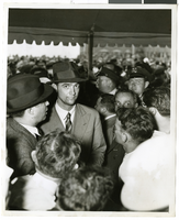
Photograph of Howard Hughes at Floyd Bennett Airfield, New York, July 14, 1938
Date
1938-07-14
Archival Collection
Description
A view of Howard Hughes, surrounded by crowds, after arriving in New York.
Image
Pagination
Refine my results
Content Type
Creator or Contributor
Subject
Archival Collection
Digital Project
Resource Type
Year
Material Type
Place
Language
Records Classification
