Search the Special Collections and Archives Portal
Search Results
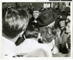
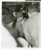
Crowd standing outside City Hall while Howard Hughes and his crew get their picture taken in celebration of Hughes's completion of his around-the-world flight in New York City, 1938 July 15
Level of Description
Archival Collection
Collection Name: Howard Hughes Public Relations Photograph Collection
Box/Folder: Folder 12
Archival Component
T-Shirt Color: Gray; Front: City Of New York Fire Dept. FDNY, Dept. Badge W/ New York City Sky Line, approximately 2001-2012
Level of Description
Archival Collection
Collection Name: New York-New York Hotel and Casino 9-11 Heroes Tribute Collection
Box/Folder: Box 357
Archival Component
New York-New York Hotel and Casino 9-11 Heroes Tribute Collection
Identifier
Abstract
The New York-New York Hotel and Casino 9-11 Heroes Tribute Collection consists of materials from the "Heroes of 9-11" display that was at the New York-New York Hotel and Casino in Las Vegas, Nevada from 2001 to 2012. The materials primarily consist of more than 5,000 t-shirts left at the memorial by visitors to Las Vegas, mostly from fire departments and law enforcement agencies from around the United States. Visitors left shirts and other items at the memorial as a sign of respect for the men and women who died during the terrorist attacks in New York City and Washington, D.C. on September 11, 2001. The collection also houses memorabilia and other items left at the memorial, including flags, hats, pins, buttons, flowers, and embroidered emblems and insignias. The materials also contain documentation of the memorial, including promotional and press materials, video recordings from the news media, photographs, and newspaper articles.
Archival Collection
#71630: New student orientation sessions held in the Student Union on July 7, 2017, 2017 July 07
Level of Description
Archival Collection
Collection Name: University of Nevada, Las Vegas Creative Services Records (2010s)
Box/Folder: Digital File 01
Archival Component

Photograph of Howard Hughes at Floyd Bennett Airfield, New York, July 14, 1938
Date
Archival Collection
Description
Image

Photograph of Howard Hughes at Floyd Bennett Airfield, New York, July 14, 1938
Date
Archival Collection
Description
Image

Photograph of Howard Hughes at Floyd Bennett Airfield, New York, July 14, 1938
Date
Archival Collection
Description
Image

Photograph of Howard Hughes at Floyd Bennett Airfield, New York, July 14, 1938
Date
Archival Collection
Description
Image
