Search the Special Collections and Archives Portal
Search Results

Nevada Library Notes
Date
1951 to 1958
Description
Nevada Library Notes, Vol. 1-4 issued by the Nevada State Library. Materials about the news of library activities and articles for publication by Nevada librarians.
Text
Nevada Library Notes
Date
1958 to 1960
Description
Nevada Library Notes, Vol. 5-6 issued by the Nevada State Library. Materials about the news of library activities and articles for publication by Nevada librarians.
Text

Nevada Library Notes
Date
1960 to 1961
Description
Nevada Library Notes, Vol. 7 issued by the Nevada State Library. Materials about the news of library activities and articles for publication by Nevada librarians.
Text
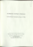
Transcript of interview with Paul J. Christensen by Claytee D. White, February 19, 2008
Date
2008-02-19
Archival Collection
Description
Personal history of Las Vegas through the eyes of a public servant. Growing up in Las Vegas during the 1940s. Education history and childhood memories. Downtown. Experiences in the US Air Force: flying B-47s loaded with nuclear bombs; training. NV Test Site. Family jewelry business in Las Vegas. Election to the board of the Las Vegas Chamber of Commerce. Election to the Las Vegas City Council and the beginning of a career in politics. Jam auction. Tussle with the Clark County Commission over wastewater in the valley: details of the dispute, extended to the state and Environmental Protection Agency. Move to the County Commission and why? The Mob during the 1950s and 60s. The Mormon community in Las Vegas. Howard Hughes. Experiences sitting on the County Commission. Chairman of the Convention Authority. Remarks on Las Vegas' future water supply. Election defeat. Corruption on the County Commission (Erin Kenny). Distinguished Nevadan award. County Hospital. Quick Care Centers. Opinion on the growth of Las Vegas. Speedway Children's Charities. Dina Titus. Experiences with African Americans. Lucy Stewart. Beaver, NV.
Text
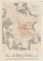
Map and basin profiles showing thickness of valley-fill deposits, Las Vegas Valley, Nevada, 1981 (color variation)
Date
1981
Description
At top of map: 'Department of the Interior. U.S. Geological Survey. Water supply paper2320-A, plate 5.' 'Prepared in cooperation with the Clark County Department of Comprehensive Planning.' At bottom of map: 'Base from U.S. Geological Survey, 1:100,000, Boulder City, Ariz.-Nev., Las Vegas, Nev.-Calif., Mesquite Lake, Nev.-Calif., 1978; Lake Mead, Nev.-Ariz., 1979.' 'Geology from Malmberg (1965); Longwell and others (1965); Haynes (1967); Bell and Smith (1980); Bell (1981) and J. R. Harrill, 1976. Thickness of valley-fill deposits by R.W. Plume, 1981.' Includes three profiles. Shows township and range lines. Scale 1:100.000 (W 115°30´--W 115°00´/N 36°30´--N 36°00´). Series: U.S. Geological Survey water-supply paper, 2320-A. Originally published as plate 5 of Ground-water conditions in Las Vegas Valley, Clark County, Nevada. Part I. Hydrogeologic framework / by Russell W. Plume, published by the U.S. Geological Survey in 1989 as Water-supply paper 2320-A.
Image
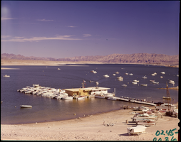
Film transparency of Las Vegas Bay, Lake Mead, Nevada, 1961
Date
1961
Archival Collection
Description
Boats are moored at the marina, as well as offshore. Some boats are on the beach, waiting to launch. A few small islands are visible in the background. Las Vegas Bay is a bay at the western edge of Lake Mead, to the northeast of the city of Henderson, Nevada, near the junction of Lake Mead Drive and Lake Mead Boulevard. A public campground and boat access are available in Las Vegas Bay. Low water levels of Lake Mead have rendered the marina there inoperable, and it relocated to the Hemenway Boat Harbor, in the south end of the Boulder Basin in 2002. The launch ramp there has also been closed due to the water levels. The Lake Mead Marina was relocated to the Hemenway Boat Harbor in 2008. The bay is the natural discharge point for the Las Vegas Wash. Las Vegas Wash is in the southeastern portion of the Las Vegas Valley and is approximately 12 miles long, from its headwaters northwest of Las Vegas to its mouth at Las Vegas Bay on the western portion of Lake Mead. The bridge across the Wash on Northshore Road is approximately 1.2 miles north of the intersection of Lakeshore and Northshore Roads.
Image
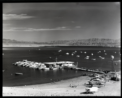
Film transparency of Las Vegas Bay, Lake Mead, Nevada, 1961
Date
1961
Archival Collection
Description
Boats are moored at the marina, as well as offshore. Some boats are on the beach, waiting to launch. A few small islands are visible in the background. Las Vegas Bay is a bay at the western edge of Lake Mead, to the northeast of the city of Henderson, Nevada, near the junction of Lake Mead Drive and Lake Mead Boulevard. A public campground and boat access are available in Las Vegas Bay. Low water levels of Lake Mead have rendered the marina there inoperable, and it relocated to the Hemenway Boat Harbor, in the south end of the Boulder Basin in 2002. The launch ramp there has also been closed due to the water levels. The Lake Mead Marina was relocated to the Hemenway Boat Harbor in 2008. The bay is the natural discharge point for the Las Vegas Wash. Las Vegas Wash is in the southeastern portion of the Las Vegas Valley and is approximately 12 miles long, from its headwaters northwest of Las Vegas to its mouth at Las Vegas Bay on the western portion of Lake Mead. The bridge across the Wash on Northshore Road is approximately 1.2 miles north of the intersection of Lakeshore and Northshore Roads.
Image
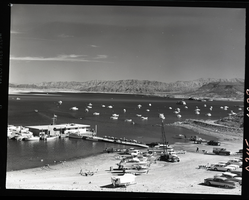
Film transparency of Las Vegas Bay, Lake Mead, Nevada, 1961
Date
1961
Archival Collection
Description
Boats are moored at the marina, as well as offshore. Some boats are on the beach, waiting to launch. A few small islands are visible in the background. Las Vegas Bay is a bay at the western edge of Lake Mead, to the northeast of the city of Henderson, Nevada, near the junction of Lake Mead Drive and Lake Mead Boulevard. A public campground and boat access are available in Las Vegas Bay. Low water levels of Lake Mead have rendered the marina there inoperable, and it relocated to the Hemenway Boat Harbor, in the south end of the Boulder Basin in 2002. The launch ramp there has also been closed due to the water levels. The Lake Mead Marina was relocated to the Hemenway Boat Harbor in 2008. The bay is the natural discharge point for the Las Vegas Wash. Las Vegas Wash is in the southeastern portion of the Las Vegas Valley and is approximately 12 miles long, from its headwaters northwest of Las Vegas to its mouth at Las Vegas Bay on the western portion of Lake Mead. The bridge across the Wash on Northshore Road is approximately 1.2 miles north of the intersection of Lakeshore and Northshore Roads.
Image
Pagination
Refine my results
Content Type
Creator or Contributor
Subject
Archival Collection
Digital Project
Resource Type
Year
Material Type
Place
Language
Records Classification


