Search Results
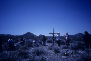
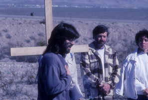
Way of the Cross protesters at Nevada Test Site: photographic slide
Date
Archival Collection
Description
From the Sister Klaryta Antoszewska Photograph Collection (PH-00352).
Image
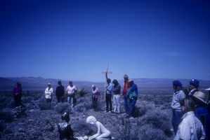
Way of the Cross protesters at Nevada Test Site: photographic slide
Date
Archival Collection
Description
From the Sister Klaryta Antoszewska Photograph Collection (PH-00352).
Image

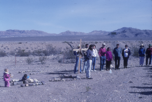
Way of the Cross protesters at Nevada Test Site: photographic slide
Date
Archival Collection
Description
From the Sister Klaryta Antoszewska Photograph Collection (PH-00352).
Image

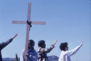
Way of the Cross protesters at Nevada Test Site: photographic slide
Date
Archival Collection
Description
From the Sister Klaryta Antoszewska Photograph Collection (PH-00352).
Image

Way of the Cross protesters at Nevada Test Site: photographic slide
Date
Archival Collection
Description
From the Sister Klaryta Antoszewska Photograph Collection (PH-00352).
Image

Way of the Cross protesters at Nevada Test Site: photographic slide
Date
Archival Collection
Description
From the Sister Klaryta Antoszewska Photograph Collection (PH-00352).
Image
Way of the Cross protesters at Nevada Test Site: photographic slide
Date
Archival Collection
Description
From the Sister Klaryta Antoszewska Photograph Collection (PH-00352).
Image
Way of the Cross protesters at Nevada Test Site: photographic slide
Date
Archival Collection
Description
From the Sister Klaryta Antoszewska Photograph Collection (PH-00352).
Image
Way of the Cross protesters at Nevada Test Site: photographic slide
Date
Archival Collection
Description
From the Sister Klaryta Antoszewska Photograph Collection (PH-00352).
Image

Way of the Cross protesters at Nevada Test Site: photographic slide
Date
Archival Collection
Description
From the Sister Klaryta Antoszewska Photograph Collection (PH-00352).
Image