Search Results
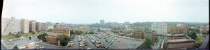
Kansas City buildlings, Kansas City, Missouri: panoramic photographs
Date
1982-10-02
Archival Collection
Description
From the Bob Paluzzi Panoramic Photographs
Image
T-Shirt Color: White; Front: Fire Department City Of New York You Will Not Be Forgotten September 11, 2001, City Of New York Fire Emblem; Back: IAFF Rockford Firefighters Salute America's Heroes, WTC Flag Raising; Handwritten Text: God Bless The Fallen Heroes Of 9/11& Their Families From The Firefighters Of Rockford Il IAFF Local #413 Engine # 7, approximately 2001-2012
Level of Description
File
Archival Collection
New York-New York Hotel and Casino 9-11 Heroes Tribute Collection
To request this item in person:
Collection Number: MS-00459
Collection Name: New York-New York Hotel and Casino 9-11 Heroes Tribute Collection
Box/Folder: Box 411
Collection Name: New York-New York Hotel and Casino 9-11 Heroes Tribute Collection
Box/Folder: Box 411
Archival Component
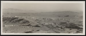
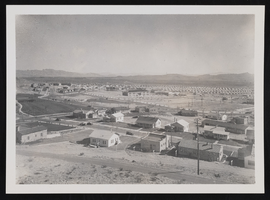
Photograph of Boulder City (Nev.), 1933
Date
1933
Archival Collection
Description
Panoramic image of Boulder City, Nevada in 1933.
Image
The Flow of Arrested Adult Defendants Through the Manhattan Criminal Court in 1968 and 1968 by John B. Jennings, the New York City Rand Institute, 1971 January
Level of Description
File
Archival Collection
Ardis Kearns Papers
To request this item in person:
Collection Number: MS-00348
Collection Name: Ardis Kearns Papers
Box/Folder: Box 16
Collection Name: Ardis Kearns Papers
Box/Folder: Box 16
Archival Component
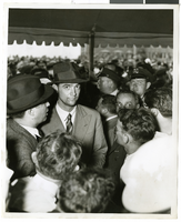
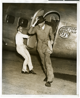
Photograph of Howard Hughes at Floyd Bennett Airfield, New York, July 14, 1938
Date
1938-07-14
Archival Collection
Description
A view of Howard Hughes, surrounded by crowds, after arriving in New York.
Image
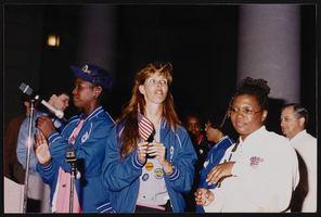
March to Los Angeles: L.A. City Hall, Culinary Union, 1992 (folder 1 of 1), image 13
Date
1992
Description
Arrangement note: Series I. Demonstrations, Subseries I.B. Other Demonstrations and Strikes
Image
Houses in Boulder City: photographic print
Date
1930 (year uncertain) to 1933 (year uncertain)
Archival Collection
Description
Homes in Boulder City, Nevada.
Image
Photograph of Howard Hughes at Floyd Bennett Field, New York, July 9, 1938
Date
1938-07-09
Archival Collection
Description
The black and white view of Howard Hughes exiting an aircraft at Floyd Bennett Field in New York.
Image
T-Shirt Color: Gray; Front: FDNL City Of New London Fire Department, Dept. Emblem; Back: Fire Department City Of New London, Engine Ladder With Two Firemen Fighting A Fire, approximately 2001-2012
Level of Description
File
Archival Collection
New York-New York Hotel and Casino 9-11 Heroes Tribute Collection
To request this item in person:
Collection Number: MS-00459
Collection Name: New York-New York Hotel and Casino 9-11 Heroes Tribute Collection
Box/Folder: Box 44
Collection Name: New York-New York Hotel and Casino 9-11 Heroes Tribute Collection
Box/Folder: Box 44
Archival Component
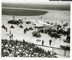
Photograph of Howard Hughes in New York, July 1938
Date
1938-07
Archival Collection
Description
A view of crowds waiting to see Howard Hughes arrive at Floyd Bennett Field in New York. Typed onto a piece of paper attached to the image: "Plane being towed after record breaking light. 7/14/38. (Daily News)"
Image