Search Results
Atlantic City, New Jersey: panoramic photograph, approximately 1978 to 1989
Level of Description
Item
Archival Collection
Bob Paluzzi Panoramic Photographs
To request this item in person:
Collection Number: PH-00414
Collection Name: Bob Paluzzi Panoramic Photographs
Box/Folder: Flat File 27, Digital File 00
Collection Name: Bob Paluzzi Panoramic Photographs
Box/Folder: Flat File 27, Digital File 00
Archival Component
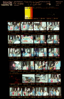
Photographs of March to Los Angeles: L.A. City Hall, Culinary Union, 1992 (folder 1 of 1)
Date
1992
Archival Collection
Description
Arrangement note: Series I. Demonstrations, Subseries I.B. Other Demonstrations and Strikes
Image
Howard Hughes at Floyd Bennett Airfield, New York, 1938 July 14
Level of Description
File
Archival Collection
Howard Hughes Public Relations Photograph Collection
To request this item in person:
Collection Number: PH-00373
Collection Name: Howard Hughes Public Relations Photograph Collection
Box/Folder: Folder 09
Collection Name: Howard Hughes Public Relations Photograph Collection
Box/Folder: Folder 09
Archival Component