Search Results
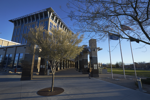
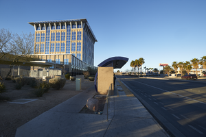
Exterior view of the North Las Vegas City Hall building, looking east-northeast in North Las Vegas, Nevada: digital photograph
Date
Archival Collection
Description
From the UNLV University Libraries Photographs of the Development of the Las Vegas Valley, Nevada (PH-00394). Part of the collection documents the entire 19 mile length of the north/south Eastern Avenue / Civic Center Drive alignment. This photograph was captured in the section of Civic Center Drive between Las Vegas Boulevard and Lake Mead Boulevard.
Image
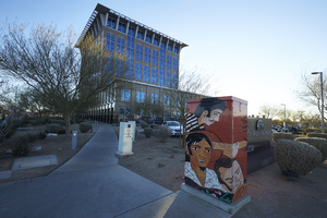
A mural on an electrical box outside of North Las Vegas City Hall, looking east in North Las Vegas, Nevada: digital photograph
Date
Archival Collection
Description
From the UNLV University Libraries Photographs of the Development of the Las Vegas Valley, Nevada (PH-00394). Part of the collection documents the entire 19 mile length of the north/south Eastern Avenue / Civic Center Drive alignment. This photograph was captured in the section of Civic Center Drive between Las Vegas Boulevard and Lake Mead Boulevard.
Image
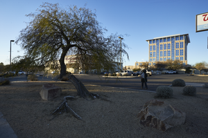
Bus stop in front of the North Las Vegas City Hall building, looking west in North Las Vegas, Nevada: digital photograph
Date
Archival Collection
Description
From the UNLV University Libraries Photographs of the Development of the Las Vegas Valley, Nevada (PH-00394). Part of the collection documents the entire 19 mile length of the north/south Eastern Avenue / Civic Center Drive alignment. This photograph was captured in the section of Civic Center Drive between Las Vegas Boulevard and Lake Mead Boulevard.
Image
Landscaping in front of North Las Vegas City Hall building and Walgreens, looking west in North Las Vegas, Nevada: digital photograph
Date
Archival Collection
Description
From the UNLV University Libraries Photographs of the Development of the Las Vegas Valley, Nevada (PH-00394). Part of the collection documents the entire 19 mile length of the north/south Eastern Avenue / Civic Center Drive alignment. This photograph was captured in the section of Civic Center Drive between Las Vegas Boulevard and Lake Mead Boulevard.
Image
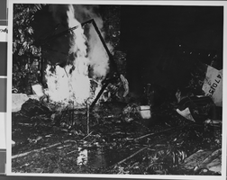
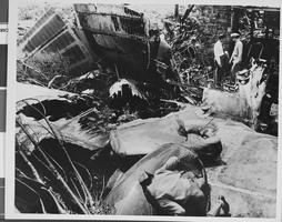
Photograph of crash of Howard Hughes' XF-11, Culver City, California, July 07, 1946
Date
Archival Collection
Description
Image
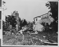
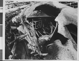
Photograph of crash of Howard Hughes' XF-11, Culver City, California, July 07, 1946
Date
Archival Collection
Description
Image
Photograph of crash of Howard Hughes' XF-11, Culver City, California, July 07, 1946
Date
Archival Collection
Description
Image
Photograph of crash of Howard Hughes' XF-11, Culver City, California, July 07, 1946
Date
Archival Collection
Description
Image