Search Results
Crowd standing outside City Hall while Howard Hughes and his crew get their picture taken in celebration of Hughes's completion of his around-the-world flight in New York City, 1938 July 15
Level of Description
Archival Collection
Archival Component
"The Likely Impact of New York City Casinos on the New York Racing Association", 1979
Level of Description
Archival Collection
Archival Component
Ashley Hall oral history interview
Identifier
Abstract
Oral history interview with Ashley Hall conducted by Claytee D. White on September 2, 2015 and September 22, 2015 for the Building Las Vegas Oral History Project. Hall discusses being the city manager of Las Vegas, Nevada during the early portion of the development of Summerlin, Nevada by the Hughes Corporation. He also discusses his earlier life before politics, pertaining to Nevada Trench Safety.
Archival Collection
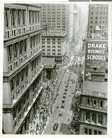
Photograph of a parade for Howard Hughes, New York City, July 15, 1938
Date
Archival Collection
Description
Image
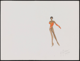
Aretha Franklin at Carnegie Hall, New York: costume design drawings, notes
Date
Archival Collection
Description
Series III. Professional work in the United States: show production materials -- Revues, concerts, and theater production materials
Mixed Content
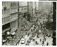
Photograph of a parade for Howard Hughes, New York City, July 15, 1938
Date
Archival Collection
Description
Image
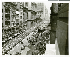
Photograph of a parade for Howard Hughes, New York City, July 15, 1938
Date
Archival Collection
Description
Image
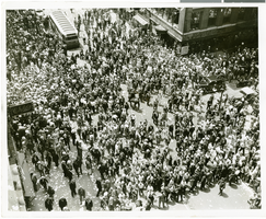
Photograph of a parade for Howard Hughes, New York City, July 15, 1938
Date
Archival Collection
Description
Image
Harry Hall oral history interview
Identifier
Abstract
Oral history interview with Harry Hall conducted by Dennis McBride on June 20, 1986 for the Boulder City Library Oral History Project. Hall discusses how the hope of work on the dam encouraged his move to Nevada with his mother and stepfather. He then talks at some length about living in a tent in Ragtown, the various illegal bootlegging establishments along the dirt road running between Las Vegas and Boulder City, Nevada, and working on the dam. He continues talking about working conditions, the heat, and the labor strike at the dam in August, 1931.
Archival Collection
Report: "Marketing Casino Gambling and a Local Lottery in New York City" by the Council of the City of New York for the Committee on Economic Development, 1991
Level of Description
Archival Collection
Archival Component