Search Results
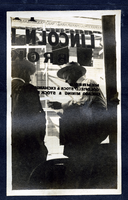
Photograph of two men outside of Lincoln Davis' brokerage office, Goldfield (Nev.), early 1900s
Date
1900 to 1925
Archival Collection
Description
Site Name: Lincoln Davis Brokerage Office (Goldfield, Nev.)
Image
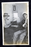
Photograph of C. A. Earle Rinker and George Lockhart in an office, Goldfield (Nev.), early 1900s
Date
1900 to 1925
Archival Collection
Description
Photograph of C. A. Earle Rinker and George Lockhart in an office, Goldfield (Nev.), early 1900s
Image
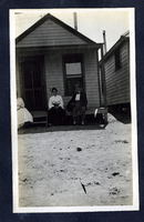
Photograph of people sitting on a cottage porch, Goldfield (Nev.), early 1900s
Date
1900 to 1925
Archival Collection
Description
Photograph of people sitting on a cottage porch, Goldfield (Nev.), early 1900s
Image
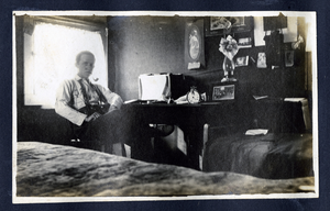
Photograph of C. A. Earle Rinker sitting at desk in a cottage, Goldfield (Nev.), early 1900s
Date
1900 to 1925
Archival Collection
Description
Photograph of C. A. Earle Rinker sitting at desk in a cottage, Goldfield (Nev.), early 1900s
Image
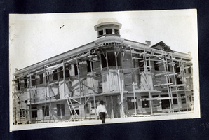
Photograph of a new building under construction, Goldfield (Nev.), early 1900s
Date
1900 to 1925
Archival Collection
Description
Photograph of a new building under construction, Goldfield (Nev.), early 1900s
Image
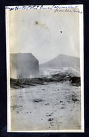
Photograph of the smoking ruins of a burned hotel, Goldfield (Nev.), early 1900s
Date
1900 to 1925
Archival Collection
Description
Photograph of the smoking ruins of a burned hotel, Goldfield (Nev.), early 1900s
Image
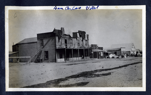
Photograph of the Esmeralda business district and San Carlos Hotel, Goldfield (Nev.), early 1900s
Date
1900 to 1925
Archival Collection
Description
Site Name: San Carlos Hotel (Goldfield, Nev.)
Image
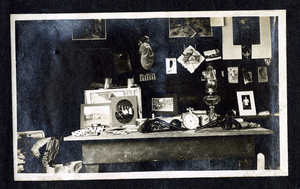
Photograph of a desk with playing cards and pistols, Goldfield (Nev.), early 1900s
Date
1900 to 1925
Archival Collection
Description
Kind of remind me of a memento mori....still life that encourages one to remember we die
Image

Photograph of a man inspecting a fishing catch, early 1900s
Date
1900 to 1925
Archival Collection
Description
Possibly from Santa Catalina fishing trip
Caption: R.J. Shoemaker's father-in-law Rochester N.Y.
Caption: R.J. Shoemaker's father-in-law Rochester N.Y.
Image
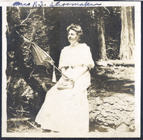
Photograph of Mrs. R. J. Shoemaker with a parasol, Los Angeles (Calif.), early 1900s
Date
1900 to 1925
Archival Collection
Description
Photograph of Mrs. R. J. Shoemaker with a parasol, Los Angeles (Calif.), early 1900s
Image