Search Results
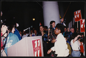
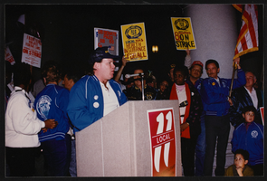
March to Los Angeles: City Hall, Culinary Union, Los Angeles (Calif.), 1992 (folder 2 of 2), image 25
Date
1992
Description
Arrangement note: Series I. Demonstrations, Subseries I.B. Other Demonstrations and Strikes
Image
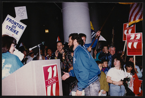
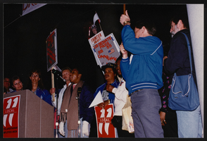
March to Los Angeles: City Hall, Culinary Union, Los Angeles (Calif.), 1992 (folder 2 of 2), image 26
Date
1992
Description
Arrangement note: Series I. Demonstrations, Subseries I.B. Other Demonstrations and Strikes
Image
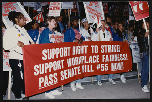
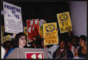
March to Los Angeles: City Hall, Culinary Union, Los Angeles (Calif.), 1992 (folder 2 of 2), image 27
Date
1992
Description
Arrangement note: Series I. Demonstrations, Subseries I.B. Other Demonstrations and Strikes
Image
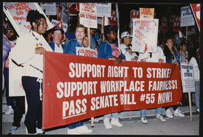
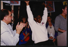
March to Los Angeles: City Hall, Culinary Union, Los Angeles (Calif.), 1992 (folder 2 of 2), image 28
Date
1992
Description
Arrangement note: Series I. Demonstrations, Subseries I.B. Other Demonstrations and Strikes
Image
March to Los Angeles: City Hall, Culinary Union, Los Angeles (Calif.), 1992 (folder 2 of 2), image 29
Date
1992
Description
Arrangement note: Series I. Demonstrations, Subseries I.B. Other Demonstrations and Strikes
Image

March to Los Angeles: City Hall, Culinary Union, Los Angeles (Calif.), 1992 (folder 2 of 2), image 30
Date
1992
Description
Arrangement note: Series I. Demonstrations, Subseries I.B. Other Demonstrations and Strikes
Image

March to Los Angeles: City Hall, Culinary Union, Los Angeles (Calif.), 1992 (folder 2 of 2), image 31
Date
1992
Description
Arrangement note: Series I. Demonstrations, Subseries I.B. Other Demonstrations and Strikes
Image
March to Los Angeles: City Hall, Culinary Union, Los Angeles (Calif.), 1992 (folder 2 of 2), image 32
Date
1992
Description
Arrangement note: Series I. Demonstrations, Subseries I.B. Other Demonstrations and Strikes
Image
March to Los Angeles: City Hall, Culinary Union, Los Angeles (Calif.), 1992 (folder 2 of 2), image 33
Date
1992
Description
Arrangement note: Series I. Demonstrations, Subseries I.B. Other Demonstrations and Strikes
Image
March to Los Angeles: City Hall, Culinary Union, Los Angeles (Calif.), 1992 (folder 2 of 2), image 34
Date
1992
Description
Arrangement note: Series I. Demonstrations, Subseries I.B. Other Demonstrations and Strikes
Image