Search the Special Collections and Archives Portal

Search Results

Displaying results 1071 - 1080 of 19602

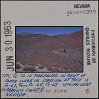
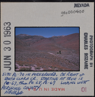
Photographic slide of geological sites in Pershing County, Nevada, circa early 1960s

Date

1960 (year approximate) to 1963 (year approximate)

Description

Written on the slide: "Site Pe-70 in foreground. On right of Santa Clara Creek starting at tree is Pe-67, then Pe-68, Pe-69. Looking west. Pershing County Nevada."

Image

Technical reports and other Yucca Mountain Site Characterization Office documents, 1958-2000

Level of Description

Series

Scope and Contents

The Technical reports and other Yucca Mountain Site Characterization Office (YMSCO) documents series (1958-2000) consists primarily of technical reports on nuclear waste and other materials relating to the Yucca Mountain Site Characterization project. Reports in this series cover studies of geologic features of Yucca Mountain, technologies tested, and potential hazards of high-level nuclear waste storage. Materials were compiled from those received from the YMSCO as well as documents pulled from the existing James R. Dickinson Library technical reports collection, including current awareness abstracts and other energy related materials, particularly solar energy.

Archival Collection

Yucca Mountain Site Characterization Office Collection
To request this item in person:
Collection Number: MS-00091
Collection Name: Yucca Mountain Site Characterization Office Collection
Box/Folder: N/A

Archival Component

Postcard showing the construction site of Hoover Dam, Black Canyon, circa 1931

Date

1931

Archival Collection

Description

A colored postcard showing an artist's representation of the construction site of Hoover Dam, previously known as Boulder Dam, in Black Canyon. Constructed in the 1930s, Hoover Dam crosses the Colorado River on the state line between Arizona and Nevada. Also considered to be an engineering wonder and the world's largest dam during its time of construction, Hoover Dam provides much-needed irrigation and hydroelectric power to the Southwest region of the United States. Transcribed onto the top border of the image: "Black Canyon, Boulder Dam Site."

Image

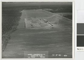
Aerial photograph of Basic Magnesium Inc. plant site, Henderson, Nevada, and Pittman, Nevada, October 8, 1941

Date

1941-10-08

Description

Air view looking north showing the Basic Magnesium Inc. plant site temporary administration building, temporary water tanks and railroad siding.

Transcribed Notes: Transcribed from front of photo: "McNeil construction Co. Magnesium plant, Las Vegas, Nevada, 10-8-41"

Image
Architectural drawing of Harrah's Resort Atlantic City, site plan, circa 1983

Date

1981 to 1984

Description

Plot plan of Harrah's Marina Hotel Casino, Atlantic City.
Site Name: Harrah's Marina Resort (Atlantic City)
Address: 777 Harrah's Boulevard, Atlantic City, NJ

Image

Photographic slide of a bathroom at a camp site at Tule Springs, Nevada, January 20, 1963

Date

1963-01-20

Description

A toilet and outhouse at a camp site at Tule Springs.

Image

Photograph of steamshovel working on the road to the Hoover Dam construction site, circa 1931

Date

1931 (year approximate)

Description

Steamshovel working on the road to the Hoover Dam construction site looking east over the Colorado River.

Transcribed Notes: Written on back: 4-18-31

Image

Photograph of bomb exploding at above ground nuclear test site in Nevada, Circa 1960

Date

1960

Description

Oversize color image of atomic bomb exploding at Nevada Test Site.

Image

Map of the Nevada Test Site and vicinity showing principal rock types and chemistry of ground water, 1964

Date

1964

Description

'Compiled by S.L. Schoff and J.E. Moore.' 'Geology generalized from geologic maps of the Nevada Test Site by Special Projects Branch, U.S. Geological Survey; of Lincoln County by Tschanz and Pampeyan (1961); and of Clark County by Bowyer, Pampeyan, and Longwell (1958).' United States Department of the Interior, Geological Survey. Prepared in cooperation with the U.S. Atomic Energy Commission.' 'TEI-838.' Scale 1:125,000 (W 116°00´--W 116°15´/N 37°15´--N 36°30´). Originally published as figure 1 in Chemistry and movement of ground water, Nevada Test Site / by Stuart L. Schoff and John E. Moore, published by the Geological Survey in 1964 as number 838 of the Trace elements investigations report.

Image

Thomas Creek Park, Site and landscape development, Details, Sheet 10 of 10

Date

1986-06 to 1987-05

Description

Dates printed on right side. Includes drawings: Bench at walk/plan, Section trash receptacle and pad, Boulders at play area, Site rock on slope, Tennis court layout, Tennis and practice court fencing, Section practice wall, Section volleyball, Tree cut out at picnic tables, Drinking fountain, Tennis post and net.