Search Results
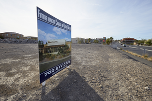
Photograph of Chabad of Green Valley future site, Henderson, Nevada, January 22, 2016
Date
2016-01-22
Archival Collection
Description
Future site of the Chabad of Green Valley located on southeast corner of Kenneth Avenue and Carnegie Drive in Henderson, Nevada.
Image
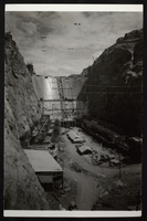
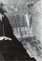
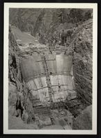
Photograph of Hoover Dam construction site, circa mid 1930s
Date
1933 to 1935
Archival Collection
Description
An image showing a downstream view of the Hoover (Boulder) Dam construction site.
Image
Photograph of Hoover Dam construction site, circa mid 1930s
Date
1933 to 1935
Archival Collection
Description
An image showing a downstream view of the Hoover (Boulder) Dam construction site.
Image
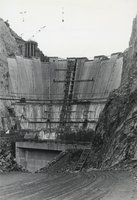
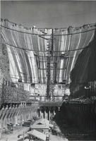
Photograph of construction site, Hoover Dam, circa early 1930s
Date
1931 to 1935
Archival Collection
Description
Black and white image of the main construction site from the downstream side of Hoover (Boulder) Dam.
Image
Photograph of construction site, Hoover Dam, circa early 1930s
Date
1931 to 1935
Archival Collection
Description
Black and white image of the main construction site from the downstream side of Hoover (Boulder) Dam.
Image
Photograph of construction site, Hoover Dam, circa early 1930s
Date
1931 to 1935
Archival Collection
Description
Black and white image of the main construction site from the downstream side of Hoover (Boulder) Dam.
Image
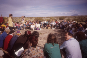
Crowd of protestors at the Nevada Test Site, Nevada: photographic slide
Date
1987-04
Archival Collection
Description
From the Sister Klaryta Antoszewska Photograph Collection (PH-00352). Protestors holding a demonstration at the Test Site.
Image
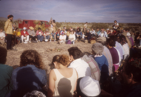
Crowd of protestors at the Nevada Test Site, Nevada: photographic slide
Date
1987-04
Archival Collection
Description
From the Sister Klaryta Antoszewska Photograph Collection (PH-00352). Protestors holding a demonstration at the Test Site.
Image
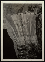
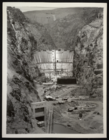
Photograph of Hoover Dam construction site, circa mid 1930s
Date
1933 to 1935
Archival Collection
Description
An image showing a downstream aerial view of the Hoover (Boulder) Dam construction site.
Image
Photograph of Hoover Dam construction site, May 29, 1934
Date
1934-05-29
Archival Collection
Description
An image showing a downstream aerial view of the Hoover (Boulder) Dam construction site.
Image