Search the Special Collections and Archives Portal

Search Results
Display    Results Per Page
Displaying results 7441 - 7450 of 19599

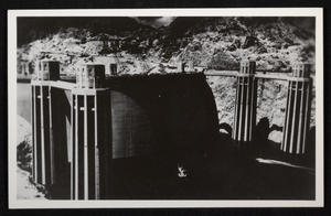
Postcard of the intake towers at Hoover Dam, circa 1935

Date

1935

Archival Collection

Description

A view of the completed intake towers and the rising waters of Lake Mead at the recently constructed Hoover (Boulder) Dam site.

Image

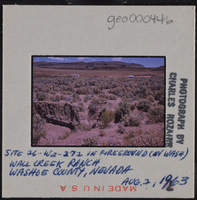
Photographic slide of Wall Creek Ranch, Nevada, August 2, 1963

Date

1963-08-02

Description

Written on the slide: "Site 26-Wa-272 in foreground (in wash). Wall Creek Ranch, Washoe County, Nevada."

Image

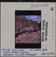
Photographic slide of a trench at Wall Creek Ranch, Nevada, August 2, 1963

Date

1963-08-02

Description

Written on the slide: "Site 26-Wa-272 in wash, btm. Wall Creek Ranch, Washoe County, Nevada."

Image

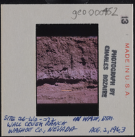
Photographic slide of a trench at Wall Creek Ranch, Nevada, August 2, 1963

Date

1963-08-02

Description

Written on the slide: "Site 26-Wa-272 in wash, btm. Wall Creek Ranch, Washoe County, Nevada."

Image

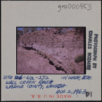
Photographic slide of a trench at Wall Creek Ranch, Nevada, August 2, 1963

Date

1963-08-02

Description

Written on the slide: "Site 26-Wa-272 in wash, btm. Wall Creek Ranch, Washoe County, Nevada."

Image

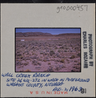
Photographic slide of Wall Creek Ranch, Nevada, August 2, 1963

Date

1963-08-02

Description

Written on the slide: "Wall Creek Ranch Site 26-Wa-272 in wash in foreground. Washoe County, Nevada."

Image

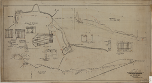
Map showing the proposed improvement of Las Vegas Springs, Las Vegas (Nev.), Clark County (Nev.), 1916

Date

1916

Description

Scale [ca. 1:240]. 1 in. to 20 feet. -- Scale [ca. 1:2,400]. 1 in. to 200 ft. Vertical scale [ca. 1:48]. 1 in. to 4 feet. -- Scale [ca. 1:4,800]. 1 in. to 100 feet ; 1 map : col. ; 40 x 78 cm ; "Scale as noted." ; "Exhibit 'A'." ; "Approved Sept. 21, 1916." ; "Div.Engr."--Lower right corner ; "W.E.J."--Lower left corner ; "L-44-50to61. T-75-17&46."--Upper left corner ; Includes discharge figures and plans for improvements to springs ; Library's copy has "Proposed layout" written on it in pencil ; Contents: Detail at springs -- Profile -- Alignment ;

Image
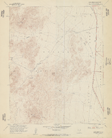
Topographic map of Cane Spring, Nevada quadrangle, 1961

Date

1961

Description

'Mapped, edited and published by the Geological Survey in cooperation with the Atomic Enegry Commission. Control by USGS, USC&GS, USCE, and Atomic Energy Commission. Topography from aerial photographs by photogrammetric methods. Aerial photographs taken 1959. Field check 1961.' Scale 1:24,000 polyconic projection (W 116°07'30"--W 116°00'00"/N 36°52'30"--N 36°45'00"). Series: 7.5 minute series (topographic). Relief shown by contours and spot heights. Contour interval 20 feet. Includes quadrangle location map. Interior--Geological Survey
For sale by the U.S. Geological Survey

Image

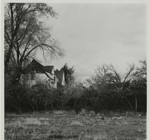
Photograph of side of the Houssels House, Las Vegas (Nev.), 1983

Date

1983

Archival Collection

Description

Houssels House at its original site (1012 S. 6th St.). This image shows the close-up view of one side of the house, mostly hidden by the dense foliage that surrounds the property. Site Name: Houssels House Street Address: 1012 South 6th Street

Image

Photograph of the side of the Houssels House, Las Vegas (Nev.), 1983

Date

1983

Archival Collection

Description

Houssels House at its original site (1012 S. 6th St.). Image shows the side of the home and the grounds leading up to the building. The house is surrounded by large trees and blooming shrubs. Site Name: Houssels House Street Address: 1012 South 6th Street

Image